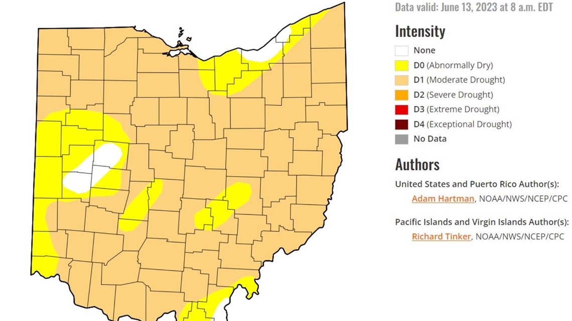
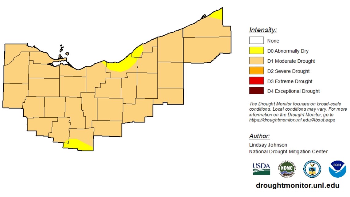
CLEVELAND — Rain finally returned this week after a lengthy stretch of dry conditions, but most of Northeast Ohio still remains in a moderate drought despite all of the recent wet weather we've experienced.
The U.S. Drought Monitor released its update Thursday morning, confirming the moderate drought status is still listed for most areas throughout the state.
This comes after our area officially reached drought designation in last week’s report.
There are improving conditions, however, for most of Cuyahoga County where the "abnormally dry" level has lifted when compared to last week.
Here's a closer glimpse at the updated drought map as of this morning:


For comparison, here’s a look at the status from last Thursday’s report U.S. Drought Monitor:


And more wet weather is on the way for later today...
3News' Payton Domschke says the Storm Prediction Center has placed us under a level one out of five with a marginal risk for severe weather this afternoon and evening.
Domschke says she's watching the 4-8 p.m. hours for this incoming system, which could include thunderstorms, heavy rain, hail and strong wind.
"We do have some lingering showers and thunderstorms beyond that, and I think tomorrow we have a few isolated sprinkles here and there," Domschke explains.

