
CLEVELAND — Monday has officially been our rainiest day since October! Cleveland Hopkins International Airport picked up a whopping 1.07" as of 5:15 pm. That's been a long time coming.
It's no secret that it's been dry around Northeast Ohio recently. Many yards are brown and the sprinklers have been working overtime. Rain has returned for Monday (Yay!!) and that will help a bit. We do have a long way to go to help with drought conditions that have developed over the last couple months.
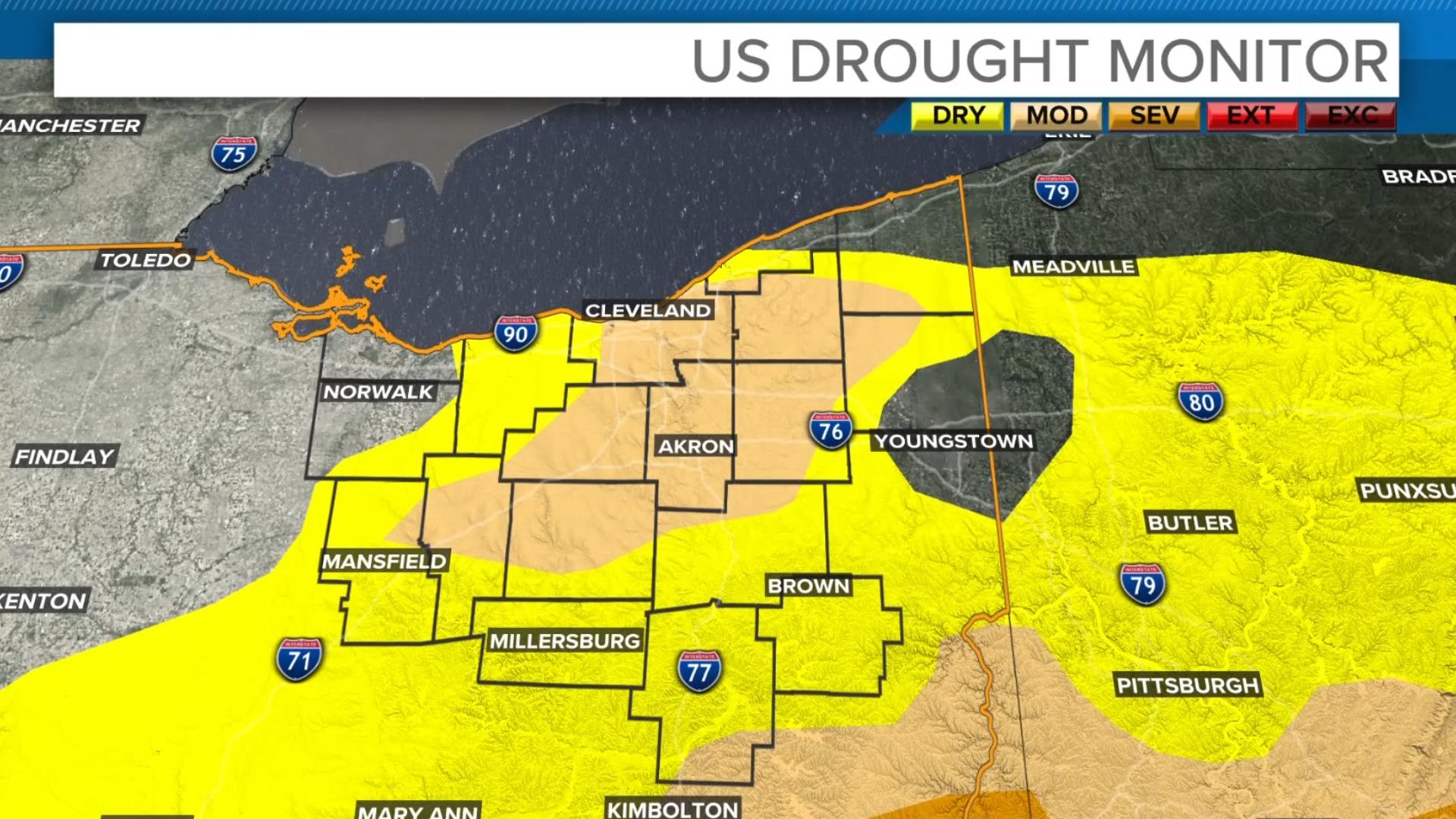
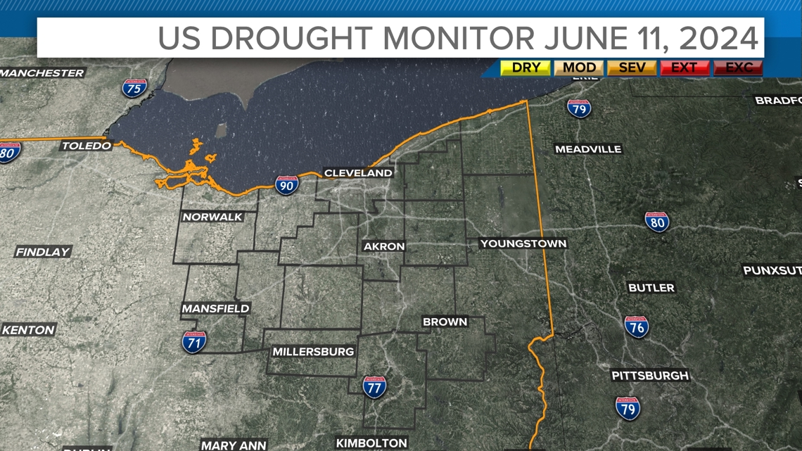
The drought monitor escalated quickly for us this summer. As late as June 11, we had no drought.

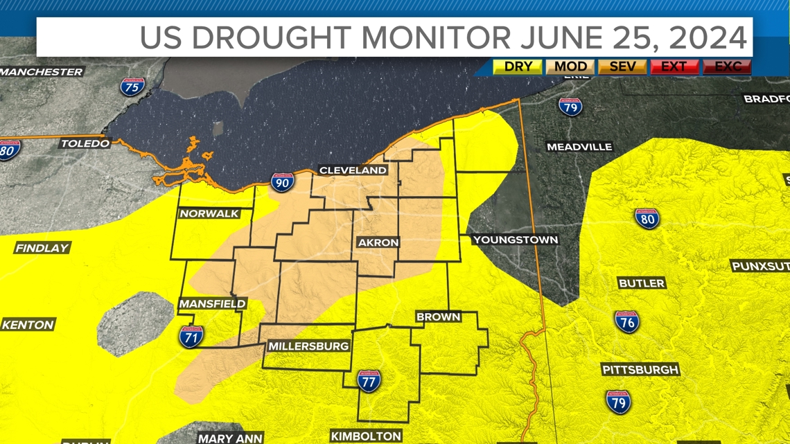
By June 18, much of the area was reported as "Abnormally Dry." By the following week, the June 25 report had increased to "Moderate Drought" for about half of the area. That area of "Moderate Drought" has been pretty persistent for the last month with very little improvement or fluctuation.

It's been a bit of a feast or famine for rainfall this summer. Northern Lake and Ashtabula counties have had a few rounds of very heavy rain, meaning a slight improvement to their drought status. Some of that rain was associated with two significant storms that also produced brief Tornado Warnings and flooding concerns.
Before Monday, heavy rain had been fairly absent at Cleveland Hopkins, where the official measurements are taken. We've been lacking in rainfall with significant coverage this summer. Most of the rain has come with pop ups and isolated showers. Monday's rain was a little more widespread. The heavy downpours are not as helpful as a slow and steady rain. That applies to drought help and traffic issues. However, we'll take whatever we can get at this point.
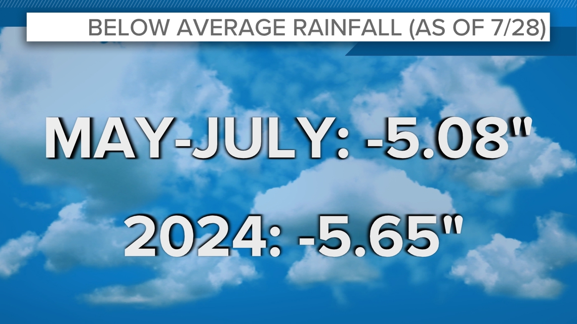
Before today's rain, Hopkins was running 5.65" below average for precipitation this year. The last three month (May 1st to July 28th) have all been below average for rain. The airport only recorded a total of 5.85" of rain for that entire time period. That's the driest that stretch of time has been since 2007.

As an interesting comparison, it's been a totally different story just over 100 miles west. Toledo is running 7.5" above average for the year. They've had several heavy rain days with totals over 1" of precip thanks to some Beryl remnants and generally being closer to the predominate storm track. Location, location, location.
We here in Northeast Ohio have rain chances in the forecast for the rest of the week as the weather remains rather humid and unsettled. Hopefully we can get some good rainfall to put a dent in our drought concerns.