
CLEVELAND — The cold air has dug in! What a change.
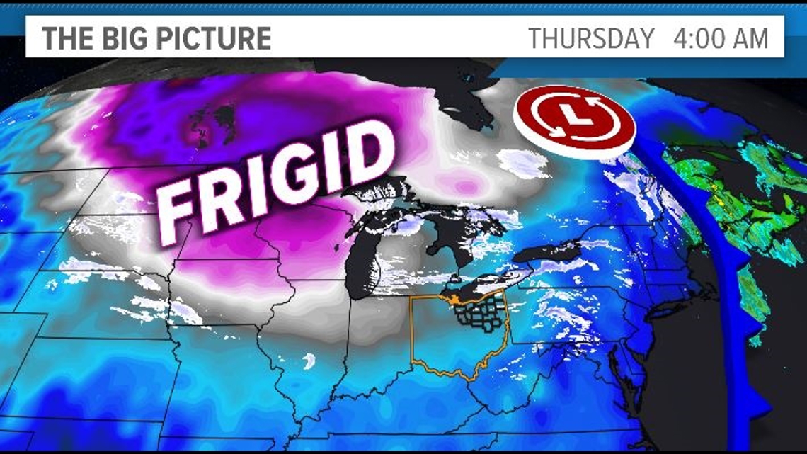
This arctic air means business! The gusty winds and frigid temps have created wind chill values -- or the number that really matters -- in the single digits through tonight and will persist into the early hours of Friday morning.

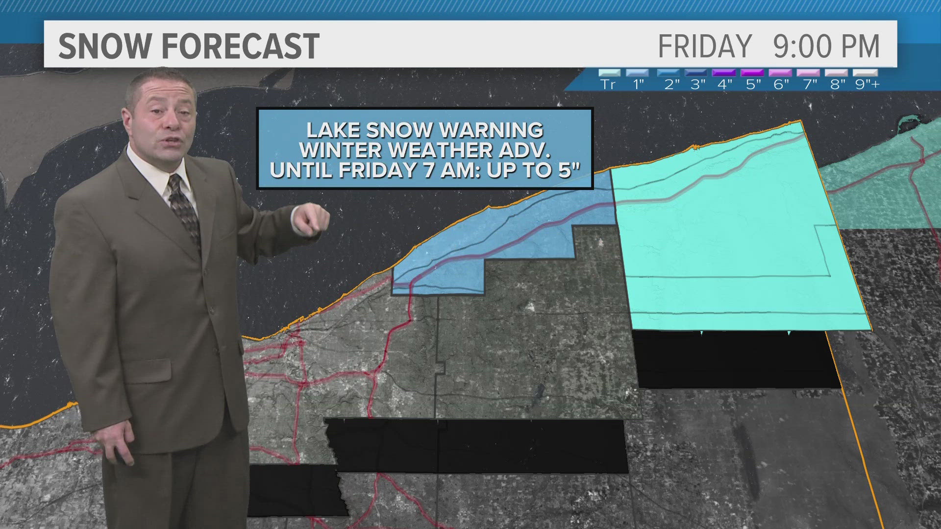
Out east, lake-effect snow will be ongoing along I-90 in Lake and especially Ashtabula counties where an additional 5 inches could pile up before it moves out Friday afternoon. Lake snow warning remains in effect for Ashtabula until 7 am.

As we turn toward the weekend, we'll begin to moderate with temps heading back into the 40s Saturday and Sunday. Rain will arrive late Saturday into Saturday night with showers likely for much of the day Sunday.
Yes, that includes the Browns game against the Chiefs.
Rain may develop again on Monday as another wave of low pressure heads our way. This looks to set us up for a colder, perhaps snowier pattern leading up toward Christmas. We'll see!
3-DAY FORECAST
TONIGHT: Frigid with lake-effect snow mainly east of Cleveland along I-90. Near 16 with wind chill values holding in the single digits.
FRIDAY: Drier with some breaks in the clouds. Few flurries east. Cold. Near 30.
SATURDAY: Mostly cloudy. Rain late. Mid 40s.
SUNDAY: Rain likely. Mid 40s.
Here are some quick weather resources you can use:
------------------------------------------------------------------------------
Get more weather from the 3News Weather team of Betsy Kling (@betsykling), Matt Wintz (@WintzWeather), Anthony Copeland (@WeatherManAC), and Jessica Van Meter (@jessicav_wx)
►MORE WEATHER | Get the latest weather headlines, video, photos & more
►ENVIRONMENT NEWS | Find out more about the world around us
►EARTH & SPACE NEWS | Learn more about our planet and outer space
►WEATHER FEATURES | Read our weather guides, storm reports & more
MORE WEATHER-RELATED HEADLINES: