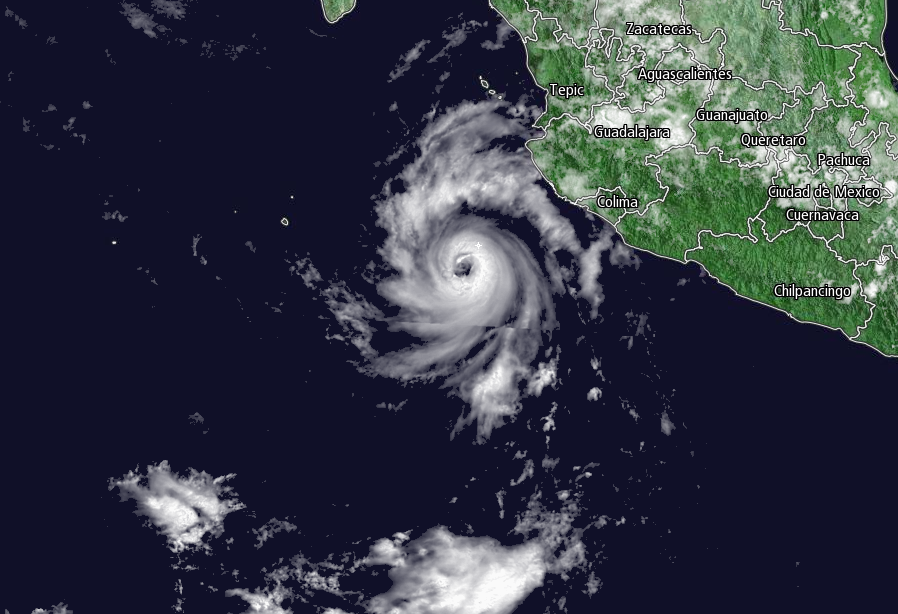
Hurricane Dora strengthened off Mexico's Pacific coast on Monday, but posed little threat to land as it spun out into the ocean.
The hurricane's maximum sustained winds early Monday were near 85 mph (140 kph) with some strengthening likely before weakening is expected to begin Tuesday.
The hurricane was centered about 175 miles (285 kilometers) southwest of Manzanillo, Mexico, and was moving west-northwest near 13 mph (21 kph).
The U.S. National Hurricane Center says Dora's forecast track shows its center staying offshore of Mexico's southwestern coast. But swells from the storm are affecting parts of Mexico's coast and are expected to cause life-threatening surf and rip current conditions.
Western Mexican states of Guerrero and Michoacan were expected to receive 1 to 2 inches (2.5 to 5 centimeters) of rain.


---
Follow the Channel 3 Weather Team on Twitter @wkycweather and on Facebook


