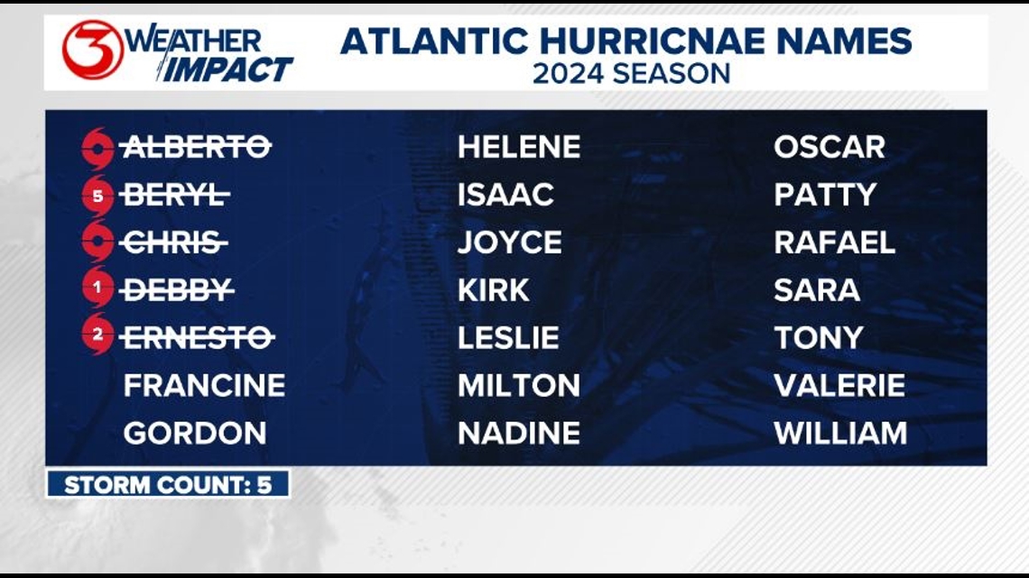
CORPUS CHRISTI, Texas — While we've seen a normal amount of hurricanes and major hurricanes through today's date, we've been slacking a bit when it comes to the number of named storms we've seen this year. By today's date, we should've already seen seven named storms - we've only seen five so far.
That being said, the tropics are definitely waking up. We're two days away from the climatological peak of hurricane season (September 10), and the NHC is currently monitoring three areas of interest, two of which are in the Central Atlantic. One has a high chance of development, the other a medium chance. We're not too concerned with these.

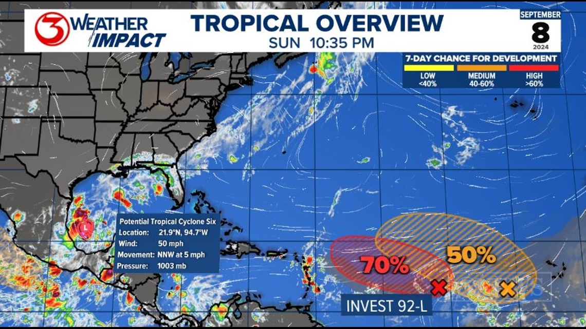
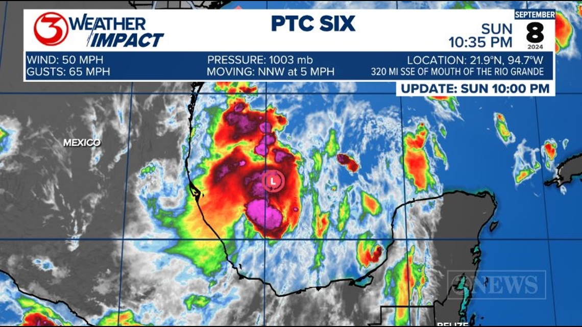
What we are keeping a close eye on is Potential Tropical Cyclone Six - formerly Invest 91-L - in the Bay of Campeche. It has a 90% chance of development into our next named system.
The PTC label means that a tropical system isn't quite yet a verifiable tropical depression or storm because it lacks a defined circulation, but it is expected to impact land within the next few days. This label allows the NHC to start issuing forecast products and tropical watches and warnings.
While its winds are tropical storm-force, PTC Six does not possess a well-defined circulation just yet - it's still more of an elongated trough. As it becomes more defined, the center of circulation could re-form anywhere in that trough as it does so. That's something to keep an eye on. It's slowly drifting northwest.

A mid-level high pressure is settling into the eastern Gulf of Mexico. This will be the main steering current for PTC Six, as forecast trends have leaned more towards a stronger, more eastward storm. A stronger storm will latch onto steering currents higher in the atmosphere, like the mid-level high.
The stronger system would pull more direct impacts away from us in the Coastal Bend. You can find our local forecast over on our forecast post.

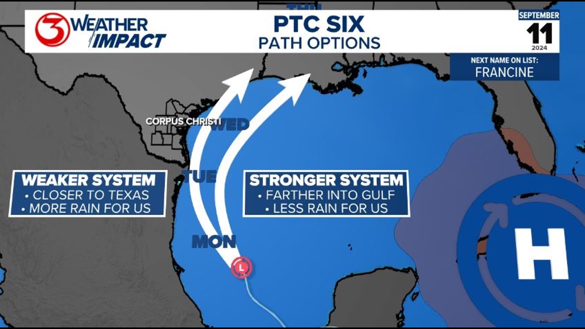
Even if we're not seeing direct impacts in the Coastal Bend, we'll still be watching for heavy tropical downpours and localized flooding, on top of hazardous beach conditions and some minor coastal flooding.
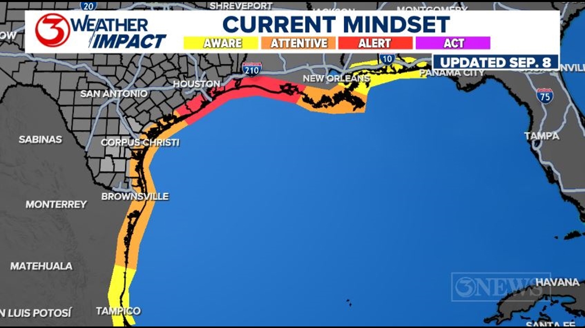
We have issued Weather Impact Alert Days for Tuesday and Wednesday due to the potential for impacts and heavy rainfall those days. We should be staying 'attentive' to the forecast for PTC Six. Our local forecast heavily hinges on how far west or east this storm tracks.

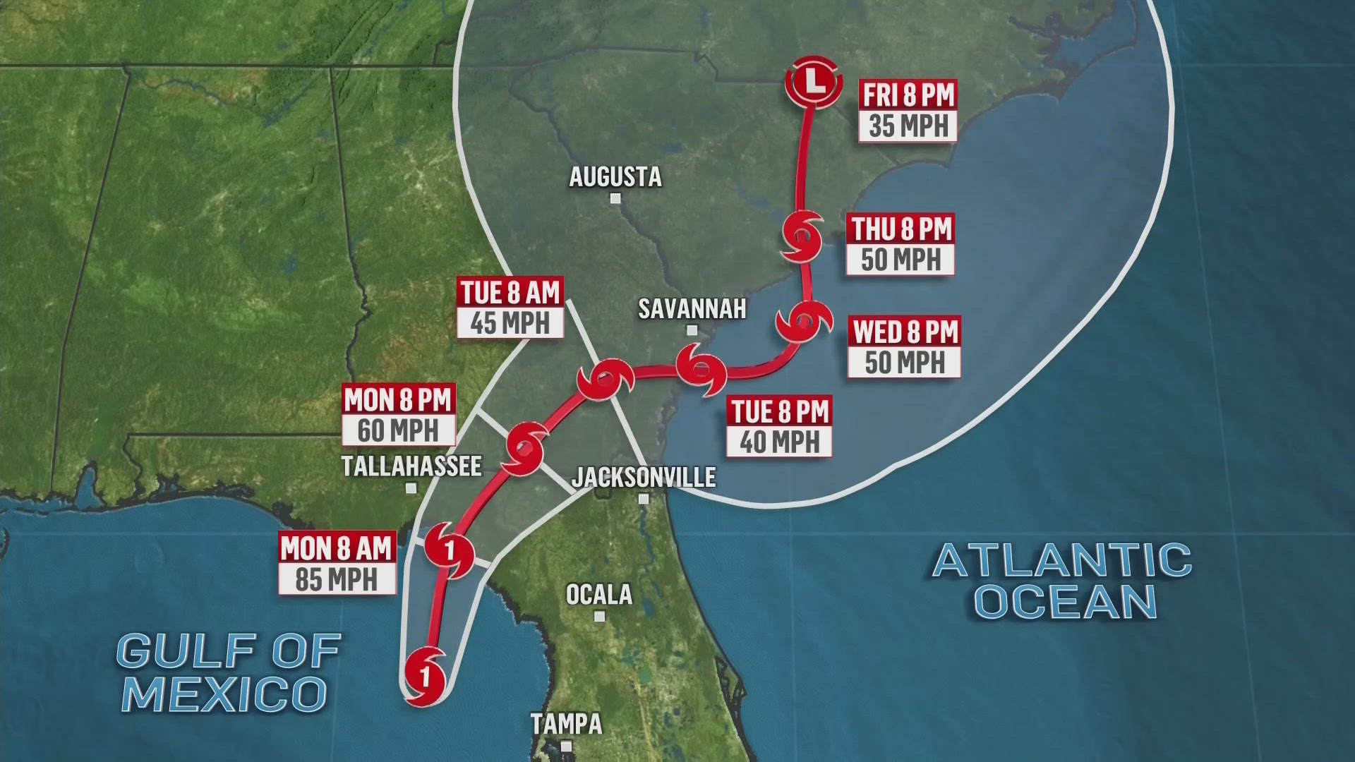
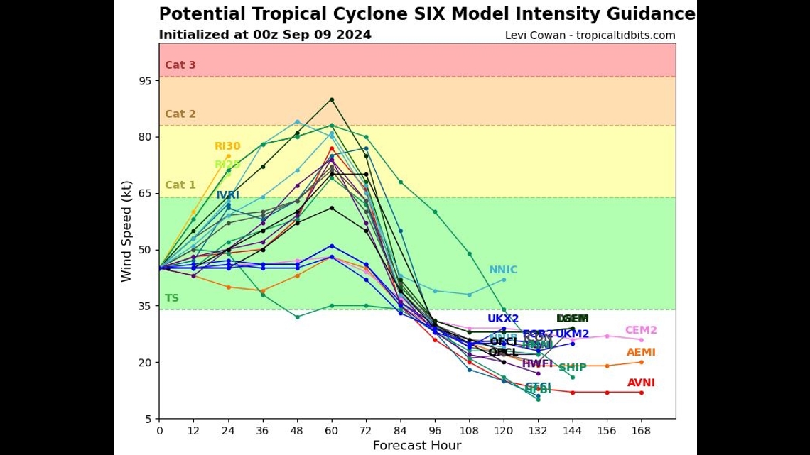
The official NHC forecast cone shows PTC Six becoming well-defined enough sometime over the next 24 hours (give or take) to be called 'Francine.' Francine continue moving northwest before turning more north as it rounds the edge of the mid-level high in the eastern Gulf.

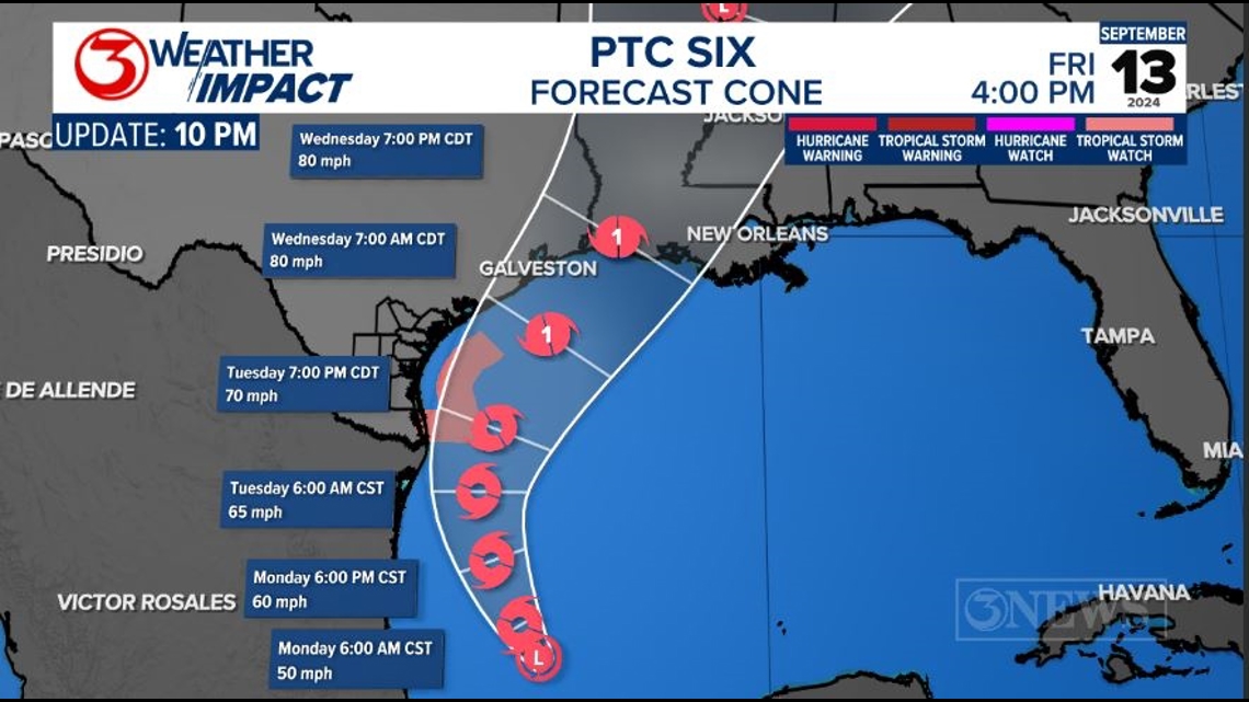
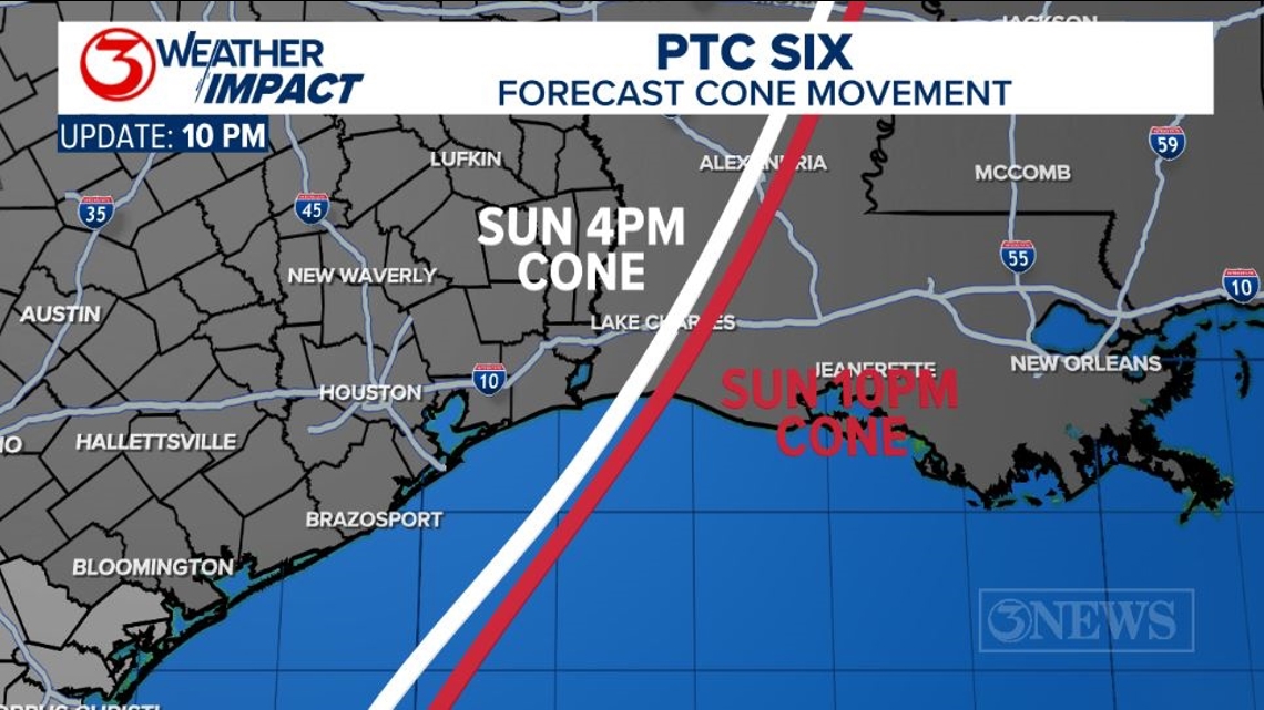
The current NHC forecast cone for PTC Six still isn't quite as far east as some models suggest. It's moreso splitting the difference right now, but their 10pm forecast cone update did shift the cone eastward ever so slightly. We'll have to watch and see if they shift the cone eastward if the trend continues.
The other noticeable change with the forecast cone was an upwards bump in the intensity forecast. The cone calls for an 80mph Category 1 hurricane at landfall, somewhere in Southeast Texas or along the Louisiana coast.

Most intensity forecast models are on board today with PTC Six becoming a hurricane as well. Last night, most models capped the storm's intensity to tropical storm-strength.
The waters in the Gulf are very warm, but some dry air may be trying to entrain into the storm as it nears landfall. At that point, Francine will also be battling wind shear near the Gulf Coast. Models show a quick decline in intensity post-landfall.

---------------------------------------------------------------
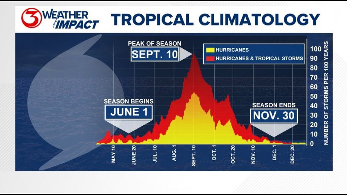
The Atlantic Hurricane Season runs from June 1 to November 30, with the peak of the climatological peak of the season happening on September 10.

Here are the names for the 2024 Atlantic Hurricane Season. Names are given to tropical cyclones (tropical storms and hurricanes).

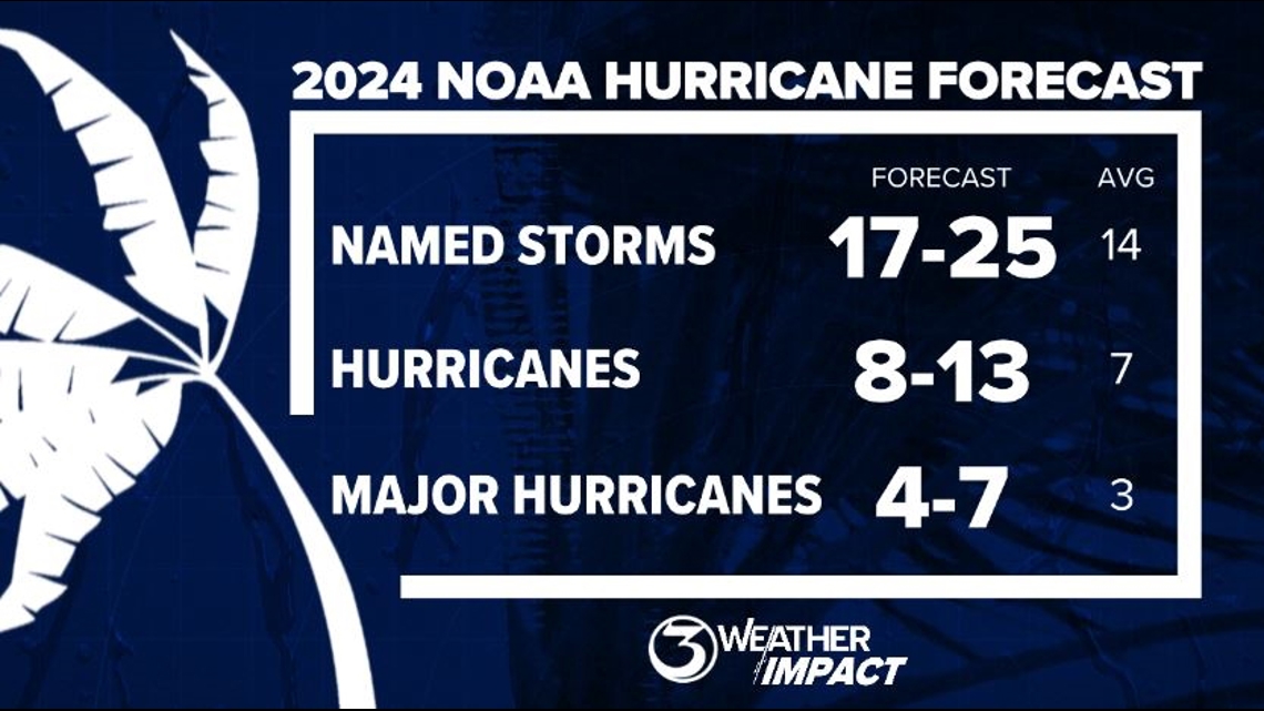
On May 23, NOAA released their forecast for the 2024 Atlantic Hurricane Season. They're predicting an above-average year, with 17-25 named storms. This is the highest pre-season forecast they've ever issued.
The high number of storms forecast is due to near-record sea surface temperatures and the return of La Nina, both of which favor tropical cyclone development. We talk more about those in our Hurricane Special, which you can watch here!

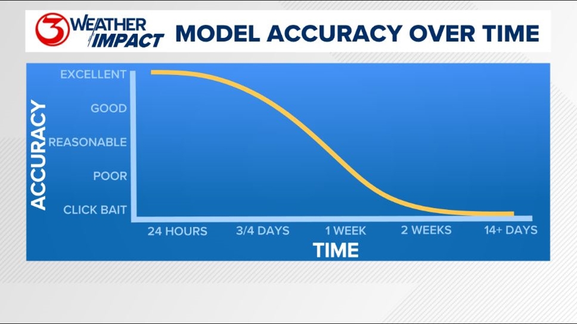
Remember to not "anchor" to the first forecast you see - forecasts change. Also, rely on a credible source for your tropical information and forecasts.