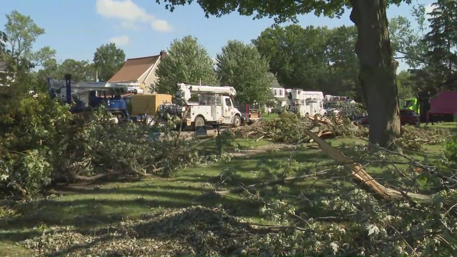
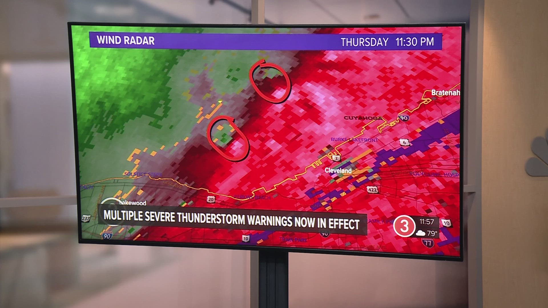
SPENCER, Ohio — The National Weather Service has confirmed a total of 12 tornadoes across Northeast Ohio that happened during severe weather late last week. Officials say no additional surveys are planned, so this appears to be the final number.
EF-0 TORNADO: Wellington
In what is expected to be its final report issued Tuesday, the NWS stated that an EF-0 tornado touched down in Wellington for about a minute beginning at 12:05 a.m. on Aug. 25. It brought peak winds of 80 mph across a path of 1.08 miles.
"The tornado began near the intersection of Meadow Land and Sheila Drive, where tops of trees were broken off and scattered across neighboring streets, residential homes, and cars," officials wrote. "A large tree was uprooted and fell along a house on Hale Street."
Per the service, the twister took down power lines and trees near Highway 18, with several limbs falling on homes. No one was injured.
EF-1 TORNADO: Bainbridge
In new details confirmed Monday, the National Weather Service says an EF-1 tornado was recorded in Bainbridge for three minutes starting at 12:16 a.m. during the storm on Aug. 25. It had peak winds of 90 mph and a path length of 1.82 miles.
"The tornado began over the west part of Laurel Springs subdivision," according to the National Weather Service. "The tornado caused extensive tree damage with two uprooted trees along homes and 100 trees blown down, twisted and snapped in different directions."
Weather officials say the tornado tracked east-southeast while blowing down several poles and trees.
"One downed tree landed on a home along Taylor May Road before it dissipated."
Nobody was hurt.
EF-0 TORNADO: Lagrange
The National Weather Service confirmed that an EF-0 tornado hit Lagrange on Friday, Aug. 25, at midnight. The brief tornado was approximately .25 miles long and 50 yards wide, with winds peaking at 85 miles per hour.
The tornado began behind a residence in Lorange, where it caused the tops of several trees to be taken off. The roof of a porch and a small portion of an adjacent roof was also blown off.
EF-2 TORNADO: Middlefield
The National Weather Service confirmed that an EF-2 tornado touchdown in Middlefield on Friday between 12:22 a.m. and 12:23 a.m. The tornado, which hit a peak of 115 miles per hour winds, was .70 miles long and 100 yards wide.
NWS officials say that the tornado began near the intersection of Burton-Windsor Road and Route 608, where it caused minor damage to the trees. The tornado quickly intensified and destroyed a barn, causing extensive damage to property.
"The entire barn was lofted and thrown approximately 150 yards due southeast and the
entire outer structure composed of cinder blocks collapsed," said NWS officials in a preliminary report.
EF-1 TORNADO: Chardon
The National Weather Service confirmed that an EF-1 tornado touched down on Friday morning in southeast Chardon. The tornado began near the intersection of Aquilla Road and Tewksburg Lane. The tornado reached a peak of 110 miles per hour winds, causing significant damage to trees and powerlines. A property was significantly impacted on Taylor Wells Road as well.
The tornado, which took place on Friday between 12:18 a.m. and 12:20 a.m., was measured to be 1.19 miles long and 175 yards wide.
EF-2 TORNADO: Warrensville Heights and Bedford Heights
NWS officials say that an EF-2 tornado hit Warrensville Heights between 12:07 and 12:09 a.m. on Friday. During the tornado, the wind reached a peak of 120 miles per hour.
The tornado began near Vera Street, just east of Green Road where several trees were blown down. The tornado went southeast across the main interchange of I-271 and I-480, emerging across Galaxy Parkway with downed trees and damage to the roofs of a car dealership and industrial park.
"The tornado continued southeast with several uprooted trees onto a home on Springfield Road and caused significant damage to two industrial buildings with brick walls
caved in and damage to support metal beams. Before the tornado lifted, more large trees were uprooted and fell on a home along and south of Miles Road just east of Highway 422," said NWS officials.
The tornado was measured to be 1.52 miles long and 100 yards wide.
EF-1 TORNADO: Spencer
NWS officials say that an EF-1 tornado hit Spencer between 12:11 and 12:13 a.m. on Friday. During the tornado, the wind reached a peak of 90 miles per hour.
The tornado began near Hunter Road, just north of Chatham Road. NWS says that aerial images revealed a track of swirls in corn fields before the tornado moved southeast into Spencer, where several trees were uprooted or snapped. The tornado caused minor damage to roof shingles of a house. The tornado ended after entering JB Firestone Memorial Park.
The tornado was measured to be 1.56 miles in length and 200 yards wide.
The Enhanced Fujita Scale classifies tornadoes into the
following categories:
- EF0...Weak......65 to 85 mph
- EF1...Weak......86 to 110 mph
- EF2...Strong....111 to 135 mph
- EF3...Strong....136 to 165 mph
- EF4...Violent...166 to 200 mph
- EF5...Violent...>200 mph
There have now been 12 tornado confirmations in Northeast Ohio from the storms that hit on Thursday night into Friday morning.
Here is a full list of the tornadoes that hit Northeast Ohio between Aug. 24-25:
- EF-0 tornado: Trumbull County
- Bristolville
- EF-1 tornado: Erie County
- Vermilion Township
- EF-1 tornado: Cuyahoga County
- Cleveland
- EF-1 tornado: Geauga County
- Bainbridge
- EF-2 tornado: Cuyahoga County
- Warrensville Heights
- Bedford Heights
- EF-1 tornado: Lake County
- Mentor
- EF-1 tornado: Ottawa/Sandusky County
- Elmore
- EF-1 tornado: Medina County
- Spencer
- EF-1 tornado: Geauga County
- Chardon
- EF-2 tornado: Geauga County
- Middlefield
- EF-0 tornado: Lorain County
- Lagrange
- EF-0 tornado: Lorain County
- Wellington
Want to be among the first to know the most important local and national news? You can download the free WKYC app and get the latest updates right on your phone: Android, Apple.
MORE COVERAGE:


