
CLEVELAND — The National Weather Service has allowed a tornado warning for the eastern portion of Holmes County to expire.
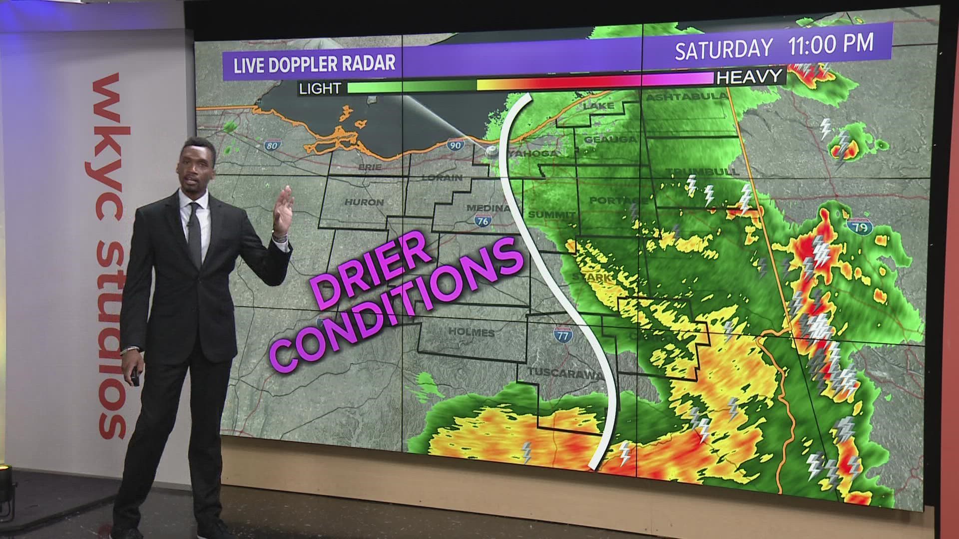
Officials first noticed a severe thunderstorm "capable of producing a tornado" near Berlin just before 8:30 p.m. Saturday moving east from Millersburg. Communities expected to be in the storm's path included Farmerstown, Walnut Creek, Sugarcreek, and Winesburg, but the warning expired just before 9 p.m., about 20 minutes sooner than expected.
Severe thunderstorm warnings have also been popping up across the region for all or parts of Ashland, Carroll, Holmes, Huron, Richland, and Tuscarawas counties have lapsed throughout the night, with possible hail accompanying wind gusts of up to 60 miles per hour. Communities in that line's path included Mansfield, Ashland, New Philadelphia, Carrollton, New London, and Millersburg.
In addition, a flood advisory was in effect for all of Holmes County as well as the southern tip of Ashland County until 10:30 p.m. Saturday. Officials say more than an inch of rain has fallen as a result of thunderstorms earlier in the evening, which could lead to "minor" flooding in communities like Mount Vernon and Millersburg.
3News meteorologist Jason Mikell had an update on the situation earlier this evening:
Following several days of mostly sunny and dry conditions, the WKYC weather team has predicted scattered thunderstorms across Northeast Ohio throughout the weekend. We'll keep you posted with any updates on the situation, as well as any reports of damage.