

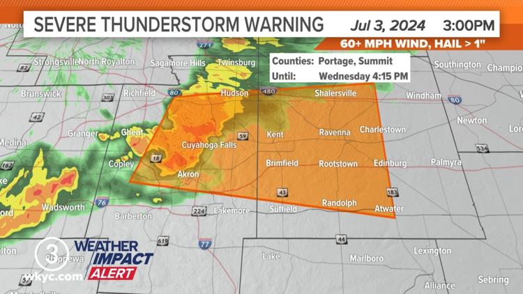
CLEVELAND — The National Weather Service has issued a Severe Thunderstorm Warning for the east central portion of Summit County and the southwestern part of Portage County until 4:15 p.m.
At 3:35 p.m., a severe thunderstorm was located over Kent, or eight miles west of Ravenna, moving east at 30 mph.
The NWS says this storm may produce 60 mph wind gusts with damage to trees and power lines.
Locations that may be impacted include: Akron, Ravenna, Cuyahoga Falls, Kent, Hudson, Tallmadge, Streetsboro, Mogadore, Stow, Brimfield, Randolph, Munroe Falls, Atwater, Edinburg, Silver Lake, Brady Lake, and Sugar Bush Knolls.
The 3News Weather Team says this system "will trigger some showers and storms through the afternoon and early evening. Some of those could have some heavier downpours and gusty winds. Just a lingering sprinkle overnight. We stay muggy with lower 70s."
Related Stories:
- FORECAST | Storms set to pop Wednesday PM
- Hurricane Beryl and sweltering heat expected to pose problems as millions travel this holiday week
- Ohio sets new record with 63rd tornado in 2024
- City of Lorain remembers 85 killed in tornado 100 years ago
- What you should do when a tornado warning is issued
- Yes, unplugging electronics before a thunderstorm can help protect them from damage