
CLEVELAND — Hold on! It's about the get really windy in Ohio on Sunday. Our next storm system will arrive late Saturday night with strong winds, large waves, and rain for the rest of the weekend.
QUICK HIGHLIGHTS
-Breezy AM southerly winds (15-25 MPH)
-Breezy PM westerly winds (20-30 MPH, gusts over 40-50+ MPH)
-Up to 10 FT waves
-Rain showers, heaviest in the morning
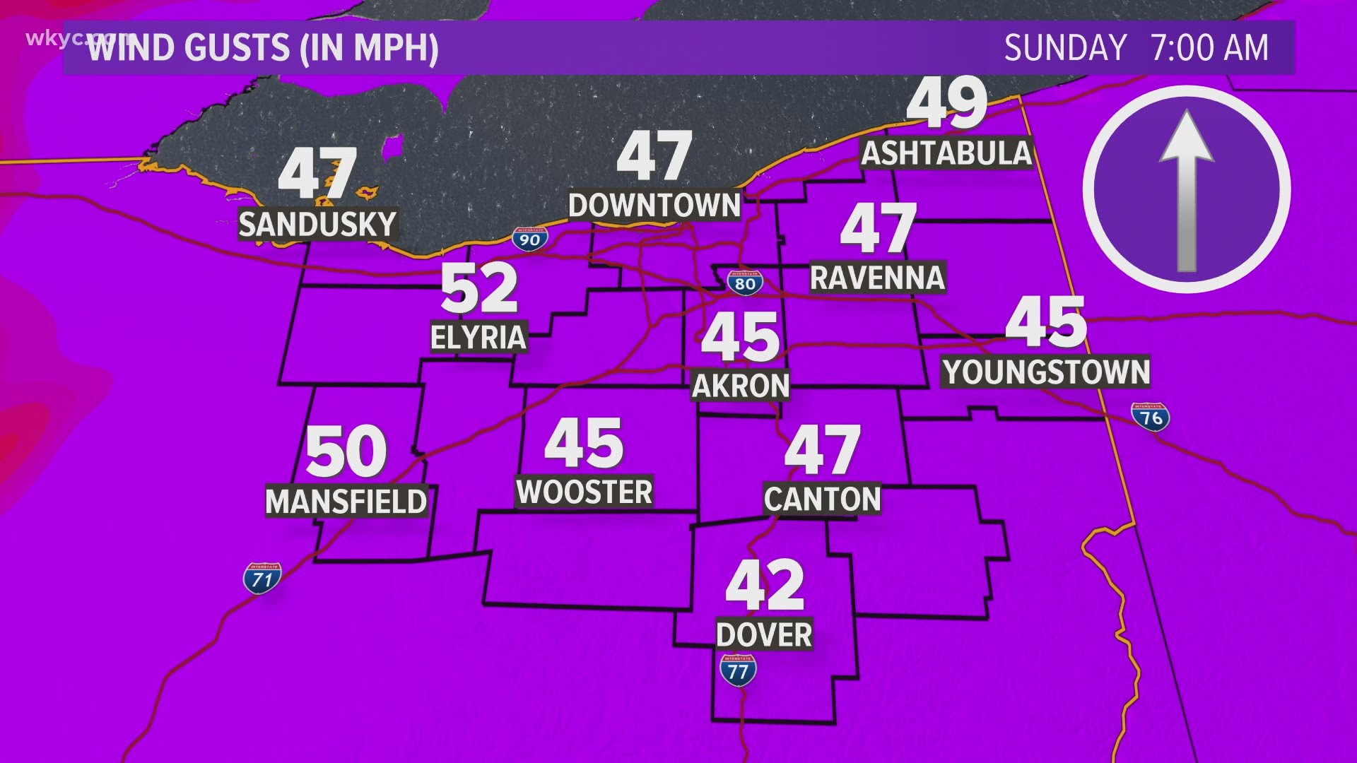
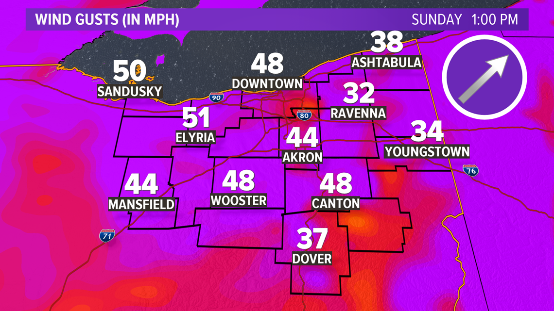
GUSTY WINDS

Everyone in Ohio is going the have strong winds. NE Ohio will likely have 20-30 MPH sustained winds with gusts up to near 50 MPH at times in the afternoon.
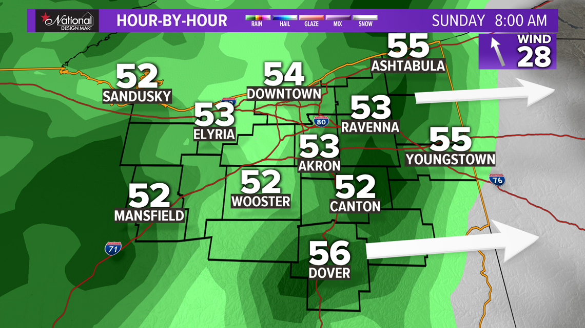
Sunday morning -- Strong winds will develop out of the south, helping temperatures to start in the 50s. (15-25 MPH, gusts 35-40 MPH)
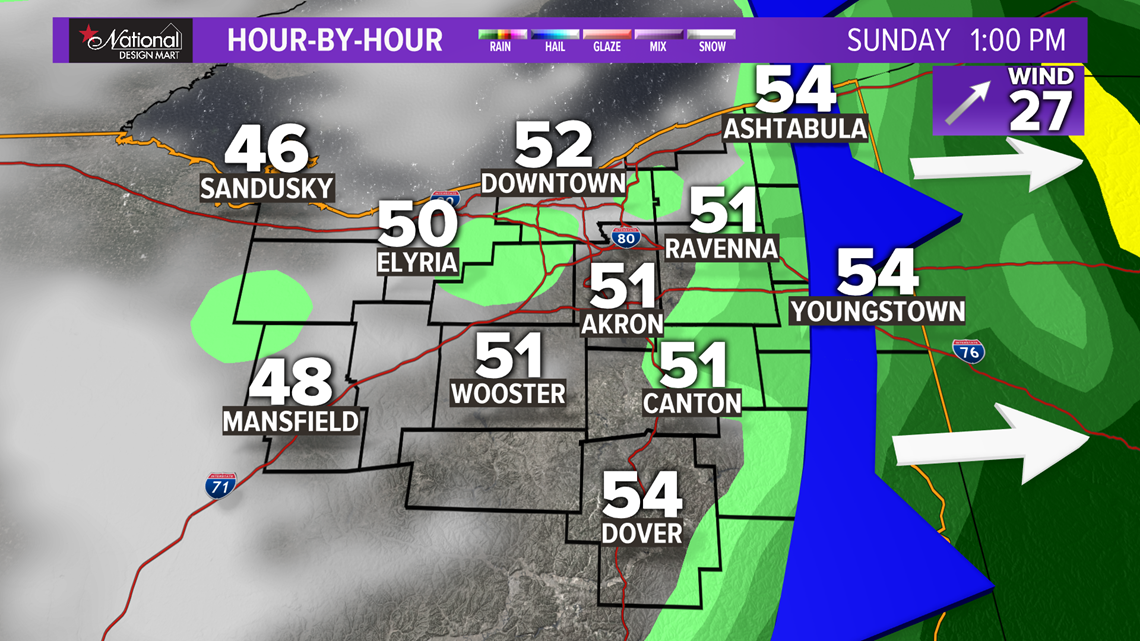
Sunday afternoon -- After the front passes through near 1-2 PM, winds will switch to westerly, helping to drop temperatures quickly into the 40s and 30s. (20-30 MPH, gusts 40-50+ MPH)
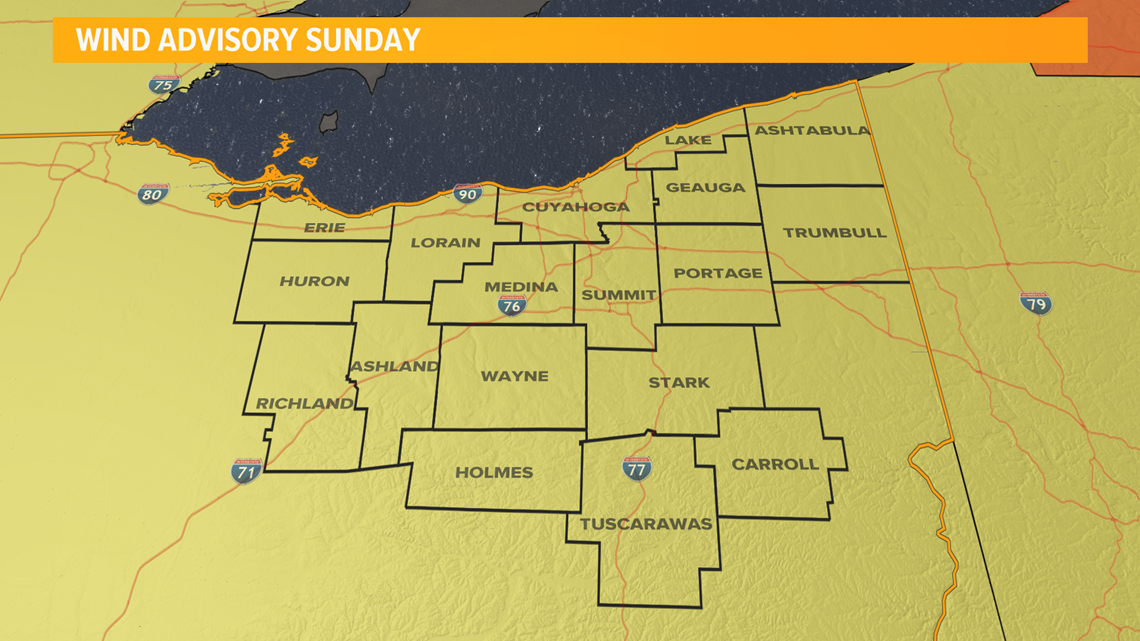
Some scattered power outages may be possible Sunday afternoon and evening. Wind advisories are in place for much of Sunday (included counties shaded in yellow).

LARGE WAVES
Wave heights are determined by wind speed and wind direction. While the water will be choppy all day, wave heights near 6-10 FT should not hit NE Ohio's shores until later in the afternoon once the winds are out of the west. (Morning south winds will create larger waves on Lake Erie's northern coast in Canada.)

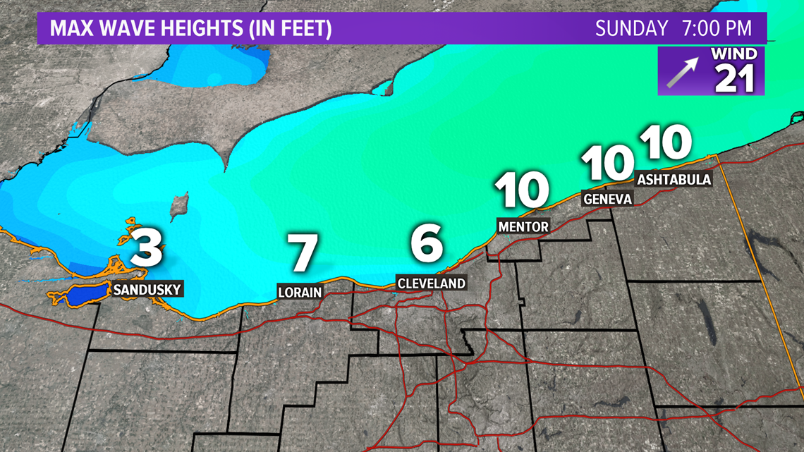
Maximum wave heights may near 10 FT especially along Lake and Ashtabula counties Sunday afternoon.
RAIN
This system should stay warm enough to keep most of our precipitation as liquid. The majority of the rain will fall Sunday morning ahead of the cold front. Afterwards, a few lake showers (maybe a few snowflakes mixing in late near the OH-PA state line) will be possible in the afternoon. With westerly winds, most lake-effect activity will be in Pennsylvania and New York.
MIDNIGHT - 7 AM: Isolated shower
7 AM - NOON: Widespread rain
NOON - Evening: Isolated shower, lake shower

Once the front swings through in the early afternoon, rain chances will go down from 90% to 30%.

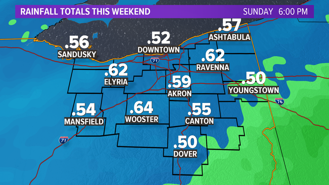
Rainfall totals should near the half-inch mark.

SEND US YOUR WEATHER PHOTOS AND VIDEO!
Think you have a picture worth submitting? Here's how to send it to us:
You can submit photos and videos through the WKYC app, and by texting a picture to 216-344-3300. Remember to include your name, where you're from, and your e-mail address or phone number with your submission so we can contact you and let you know if we plan to use what you've shared with us in one of our shows or a post.
-Matt Standridge, WKYC Meteorologist
Get more weather from the 3News Weather team of Betsy Kling (@betsykling), Hollie Strano (@holliesmiles), Matt Wintz (@WintzWeather) Jason Frazer (@JasonFrazerTV), and Matt Standridge (@StandridgeWX).
►MORE WEATHER | Get the latest weather headlines, video, photos & more
►ENVIRONMENT NEWS | Find out more about the world around us
►EARTH & SPACE NEWS | Learn more about our planet and outer space
►WEATHER FEATURES | Read our weather guides, storm reports & more