Many people along the west coast of Florida woke up Monday morning surprised to see that there was a tropical storm tracking right toward the coast.
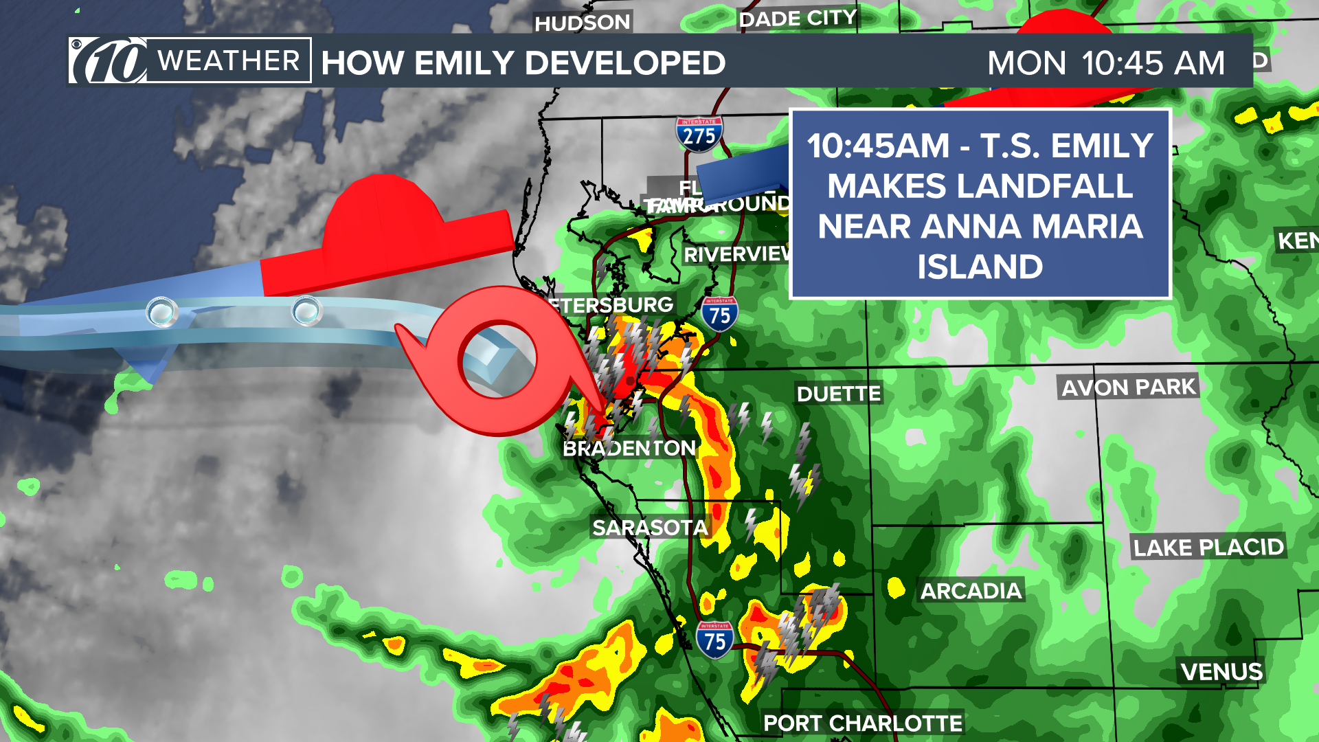
It wasn't even noon before Tropical Storm Emily had made landfall on Anna Maria Island and had already started weakening as the storm moved over central Florida.
So, where did Tropical Storm Emily come from and how did it develop so quickly?
The answer starts along a front that dropped into the Southeast United States toward the end of last week and during the weekend. As this front moved across the Gulf of Mexico, an area of low pressure started to form along the front.
This area of low pressure was the result of the spin created between the different flows in the atmosphere on either side of the front.
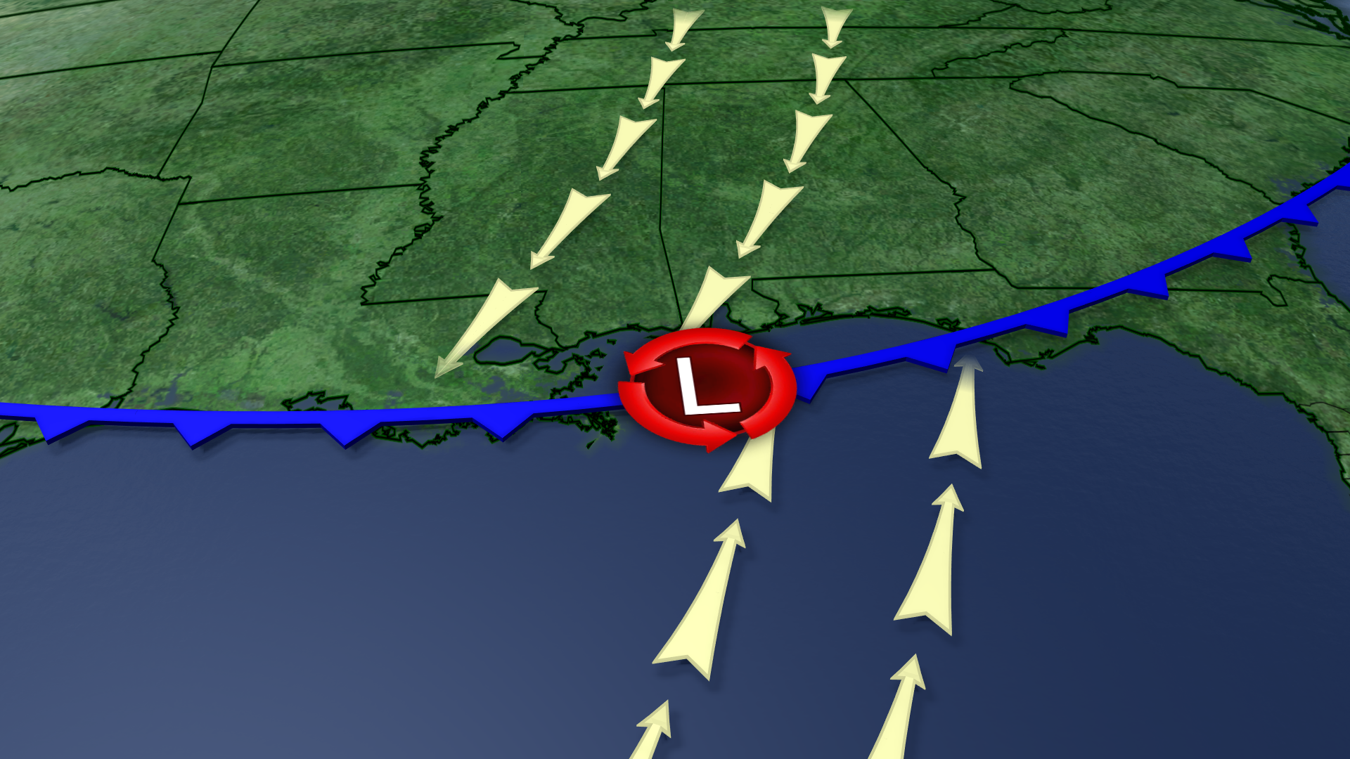
As the front continued to drop south, the area of low pressure and developing thunderstorms gathered more organization as it moved over the warmer Gulf waters to the south.
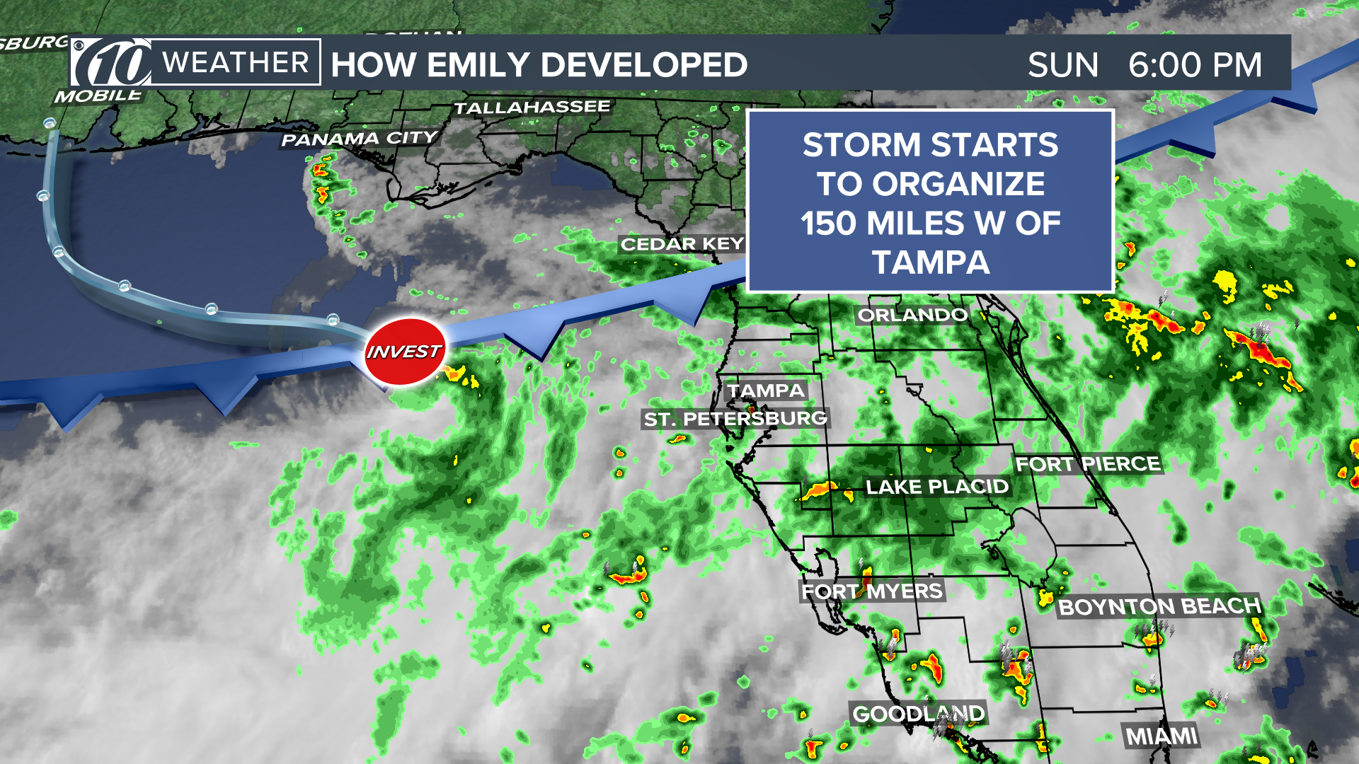
By Sunday evening, the developing area of low pressure was roughly 150 miles off the Tampa Bay Coast and had about a 20-30 percent chance of development.
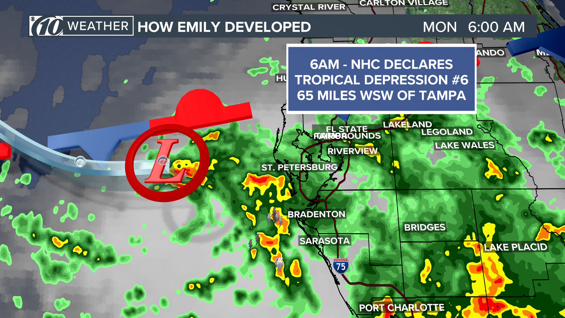
Overnight Sunday into early Monday morning, the area the circulation around the center of low pressure became much better organized. This prompted the National Hurricane Center to designate the storm as a tropical depression, Tropical Depression No. 6, at 6 a.m. At this time TD 6 was roughly 65 miles west-southwest of Tampa.
As the storm tracked to the east and its structure was more visible on radar, it became apparent that the system was not only a tropical depression but had wind speeds to meet the criteria to be upgraded to a tropical storm. A storm will acquire a name when it becomes a tropical storm.
In the case Monday, the next name on the 2017 Atlantic Hurricane Season list of names was Emily.
SAFFIR-SIMPSON HURRICANE WIND SCALE
TROPICAL DEPRESSION: Up to 38 mph
TROPICAL STORM: 39-73 MPH
CATEGORY 1: 74-95 mph
CATEGORY 2: 96-110 mph
CATEGORY 3: 111-129 mph
CATEGORY 4: 130-156 mph
CATEGORY 5: 157 mph or higher
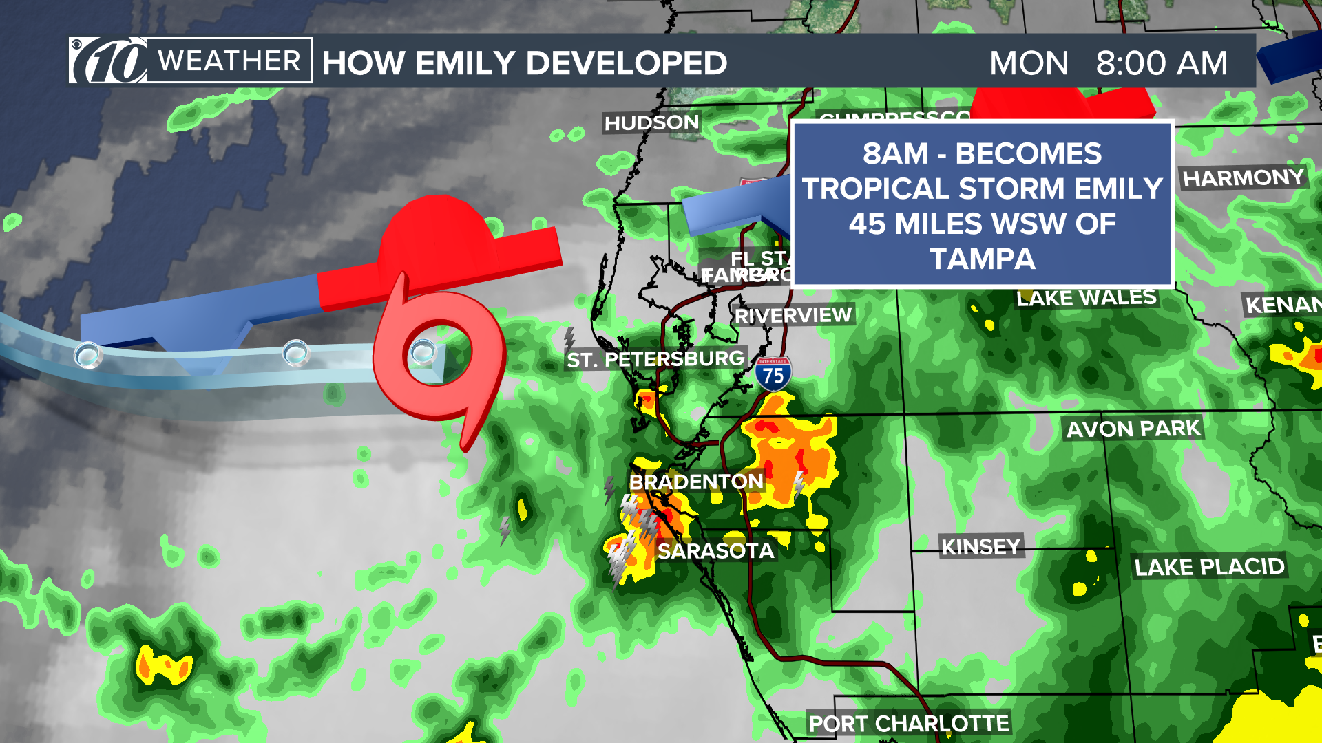
The center of Tropical Storm Emily was only 45 miles west of Tampa when it developed, which made for a very short period of time before the worst conditions were felt in the Tampa Bay Area. By 10:45 a.m., the center of Emily moved ashore over Anna Maria Island in western Manatee County.
When the storm came ashore, sustained winds associated with Emily were 45 mph with higher gusts. Emily became one of the quickest storms to develop before making landfall.
In recorded history, there have only been four storms to develop and then make landfall in a shorter period of time.
The rapid development of Emily is a perfect reminder of why we must stay on guard during hurricane season -- even if a system shows a low chance of development.
►Make it easy to keep up-to-date with more stories like this. Download the 10 News app now.
Have a news tip? Email desk@wtsp.com,visit our Facebook page or Twitter feed.

