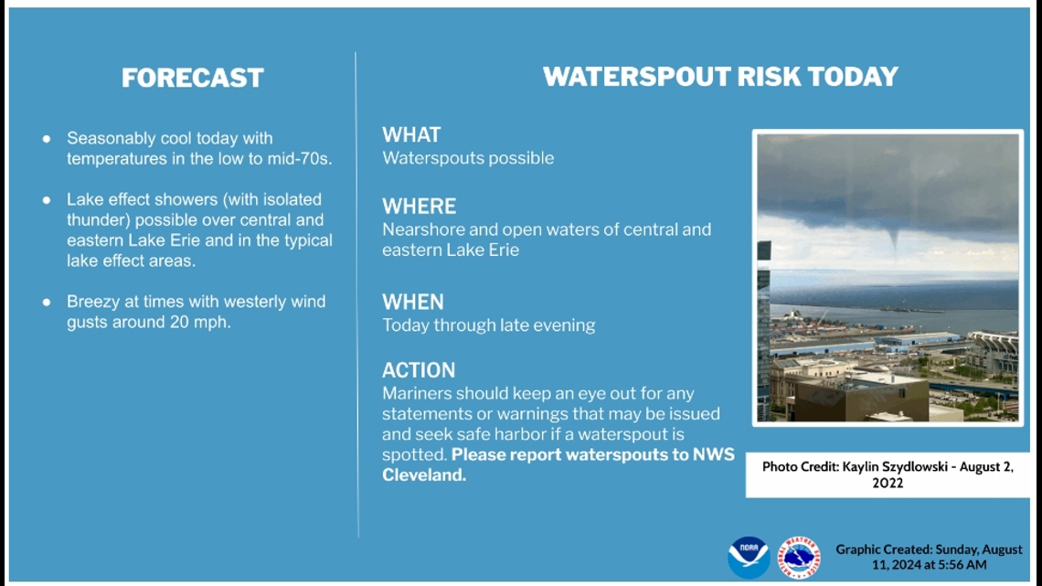
CLEVELAND — West winds will be persistent for Sunday along with below average air temperatures. Lake Erie water temperatures are still in the 70s and the air mass we have today is a little cooler than that. With that combination of temperature difference and wind, there will be some lake cloud cover, especially east of Cleveland. A few showers will also be possible for those areas to the east. The relatively cooler air will also mean the potential for waterspouts to develop today. If you're planning on hitting the beaches or heading out into the open water, keep an eye out and exercise caution.


UPDATE: Sure enough, the National Weather Service has shared images of waterspouts spotted over Lake Erie in Northeast Ohio on Sunday.
The second half of the summer season is in full swing across the North Coast. While many are enjoying the pleasures of a cool lake breeze, waterspouts can also pose a threat near the lakeshore.
According to the National Oceanic and Atmospheric Administration (NOAA), late July through September is considered waterspout season for Northeast Ohio. The reason why waterspouts are most frequent during this time period is because the water is at its warmest levels of the year. Anytime there is colder air flowing over the warmer lake (passage of a cold front), there is a potential for waterspouts.
A waterspout can be defined as a funnel containing a vortex, sometimes destructive, that covers a small area of land over a body of water. There are two types of waterspouts: tornadic and fair weather.
Tornadic waterspouts originate from true tornadoes that form over land due to a rotating thunderstorm. This rotating column of air moves from land to water, making it the most destructive of the two.
Conversely, fair-weather waterspouts form only over water. They develop at the surface of the water due to warm water temperatures and high humidity in the lowest levels of the atmosphere. The combination of low-level moisture and wind shear, winds turning with height, generates fair-weather waterspouts. They are usually small, relatively brief, and less dangerous. The fair-weather variety of waterspout is much more common than the tornadic.
Waterspouts tend to last from about two to twenty minutes and move along at speeds of 10-20 MPH.
Forecasting
Waterspouts are most common on the Great Lakes late summer into the fall season. We look at water temperature, air temperature, moisture, and wind speed in the lowest several thousand feet of the atmosphere to determine the chance of waterspouts. Waterspouts become favorable when water temperatures are warm, the air is cold and moist, and wind speeds are relatively light.
For example, on the morning of July 25, 2024, a waterspout was spotted off the coast of Cedar Point in Erie County. Leading up to the event, humidity levels were high before a strong cold front swept through. The front's passage generated a temperature difference between the air and water.
Given this setup, the National Weather Service provides an advisory outlined in the Nearshore Marine Forecast and Hazardous Weather Outlook, generally 12 - 24 hours prior. Once a waterspout has been detected by Doppler Radar or spotted, the NWS issues a Special Marine Warning. This warning polygon typically covers a larger area offshore than land-based tornado warnings because it is not uncommon for numerous waterspouts to occur simultaneously. However, for waterspouts that start offshore and make landfall, the NWS issues a Tornado Warning.
Impacts
Although waterspouts are generally weaker than a classic tornado. Waterspouts should be taken seriously. If you are a boater or a person living along the coast of the Great Lakes you should be aware of their destructive potential. When warnings are issued for waterspouts, be prepared to quickly seek safe harbor, or to find shelter out of the path of the waterspout.

