CLEVELAND — Snow is just a fact of life here in the Buckeye State, but not all snow comes to us the same way.
Statistically, Cleveland receives an average of 63.8" of snow in a season -- but we are rarely on the mark for average. Last season, Cleveland got around 25.7" snow. Our snowiest season on record was 2004-2005 when a whopping 117.9" of snow fell.
So what is the difference maker? It's all about cold air and storm tracks. Last season we had a relatively mild winter and never tapped into the main storm track. In '04-'05 we had the cold air in place and were right in the middle of a busy winter pattern.
The big storm systems, known as Delta Lows and Panhandle Hooks, are typically the ones that bring us the best shot for big snow. Aside from that, we can usually count on lake effect to bring some good snow to the primary snowbelt areas east of Cleveland.
So let's talk a little more about snowmakers for Ohio.
Delta Low

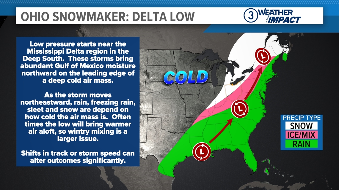
Delta Lows are known for their rapid intensification -- they can develop quickly and become powerful storms. As they move northeastward from the Gulf of Mexico, they often bring heavy precipitation and gusty winds.
One interesting feature of Delta Lows is that they often form when cold air is pushing down from the north and warm, moist air is moving up from the south. This clash of air masses is what fuels the storm and can cause temperatures to fluctuate rapidly. These shifts can result in icy conditions, especially if rain falls on freezing ground.
The "Great Blizzard of 1978" was one of the most intense winter storms in Ohio history and resulted when a Delta Low merged with an intense and cold upper level low from the Polar Vortex.
The storm dumped up to 24 inches of snow in some parts of Northeast Ohio, with snowdrifts reaching as high as 10 feet. Winds gusted at speeds of up to 60 mph creating near-zero visibility and making travel almost impossible. The snowstorm was so severe that it shut down roads, forced businesses and schools to close and left thousands of people stranded.
Temperatures during the blizzard were dangerously cold, with wind chills plummeting to 40 below zero. The freezing conditions, combined with the heavy snow, led to widespread power outages, leaving many homes without heat for several days.
In terms of impacts, the Blizzard of 1978 resulted in 51 deaths in Ohio alone, with many of those caused by accidents or exposure to the cold. The storm also caused significant property damage, especially from fallen trees and power lines.
Panhandle Hook

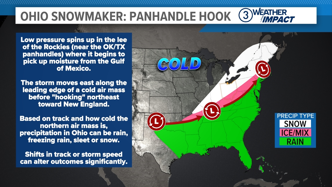
A Panhandle Hook starts as a low-pressure system in the southern Plains, often near western Oklahoma or Texas. This is where the storm begins to gather strength. As it moves east-northeast, the storm picks up moisture from the Gulf of Mexico and combines it with cold air coming from the north. This creates a lot of energy, which makes the storm stronger.
The combination of warm, moist air from the Gulf and cold air from the north creates a powerful system. When this happens, the storm can produce heavy snow, freezing rain, or sleet -- especially for areas in the Midwest and the Great Plains. The cold air is key because it turns the moisture into snow or ice rather than rain.
Panhandle Hook storms can be very impactful, so forecasting and preparation are crucial.
Clipper System

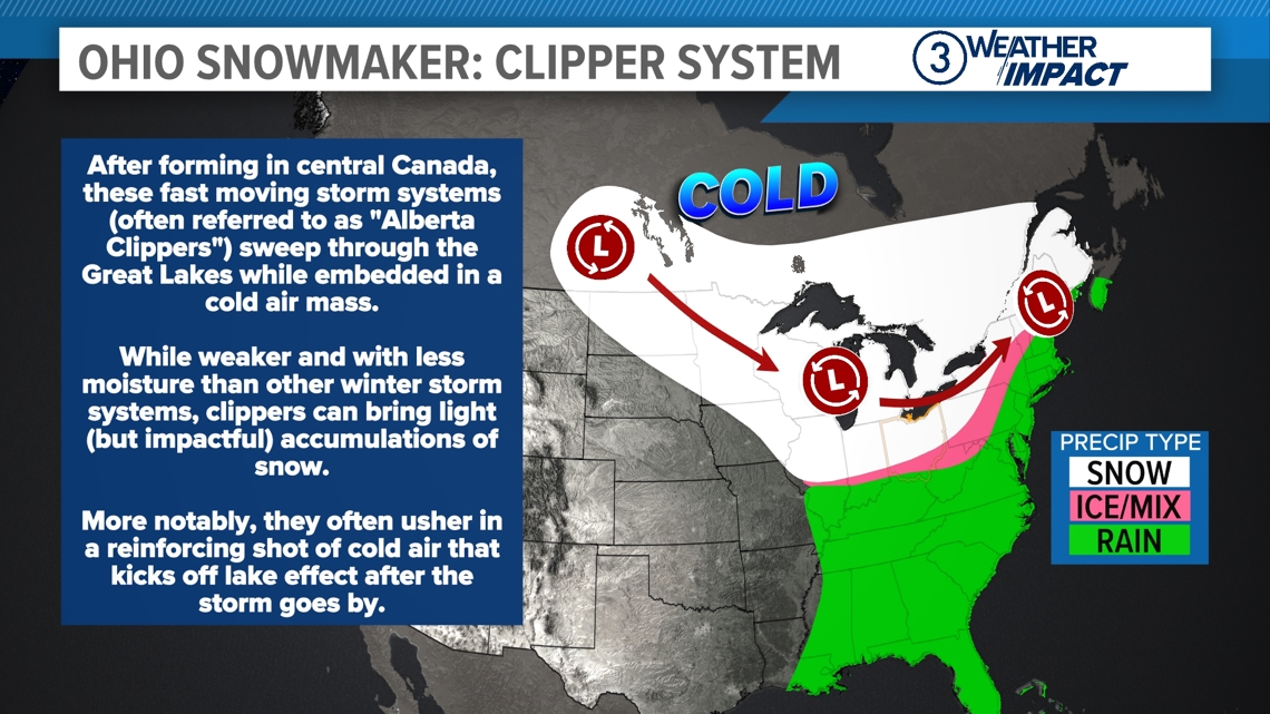
A Clipper is a type of storm that forms in the central Canadian provinces or near the Great Lakes, where cold, dry air from the Arctic region combines with moisture from other weather systems. This storm is called a “Clipper” because it moves quickly, like a clipper ship cutting through the ocean. In weather terms, this means the storm travels eastward at a fast pace, usually in less than 24 hours, and hits areas in the northern U.S., including the Great Lakes and the Midwest.
The Clipper is driven by jet streams -- fast-moving winds high in the atmosphere that can guide the storm system along its path. These jet streams are also responsible for keeping the storm system moving quickly, often limiting the amount of snow that falls in any one area. As a result, you might see several inches of snow over a short period, but it doesn’t last long. The cold air it brings is usually the biggest factor in making these storms feel harsh, even though they don’t last.
Clipper systems typically bring light to moderate snow, but it can fall heavily in some areas, especially along the storm’s path. Sometimes, the storm can produce gusty winds that make the temperature feel even colder -- the "wind chill effect." In addition to snow, Clipper systems can also cause icy conditions, especially on roads and sidewalks.
We can have more than a dozen Clipper systems pass through in a single winter season.
Lake Effect Snow

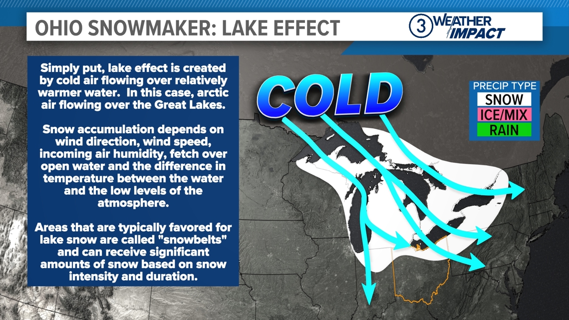
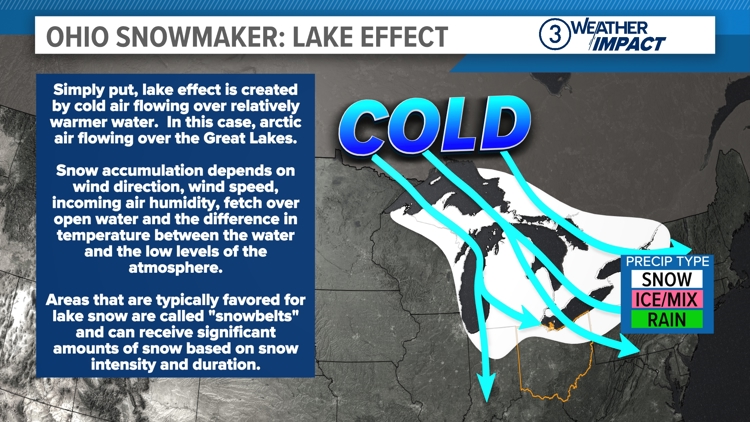
Lake effect snow is a fascinating weather phenomenon that happens when cold air moves over a large body of warmer water, like a lake. This process creates some pretty heavy snowfall, especially in regions near big lakes, like the Great Lakes in North America.
Here’s how it works: During the fall and winter, the land cools down much faster than the water in lakes. So, when cold air from the land moves over the warmer lake, it picks up moisture from the water’s surface. This moisture rises into the cold air above it. The air cools as it moves over the land, causing the moisture to condense into clouds. As these clouds gather more moisture, they become heavier and eventually release it as snow when they hit the colder air on the other side of the lake.
This effect is especially strong in places like the "snowbelt" of the United States, where the Great Lakes create perfect conditions for lake effect snow. Some of the heaviest snowfalls occur here because the air picks up so much moisture from the lakes and then dumps it on the land, creating deep snow in a short time.
We are constantly tracking weather patterns to see what types of impacts will be coming our way for the winter. If we have cold air we'll have snow, but we need a storm system to really get the flakes to fly.


