CLEVELAND — Precipitation—the water that falls from clouds—comes in many forms, including rain, snow, sleet, and freezing rain. The type we experience depends largely on the atmospheric conditions between the clouds and the ground, especially temperature and humidity. Here’s a breakdown of how these weather phenomena form, according to meteorological science.
1. Rain
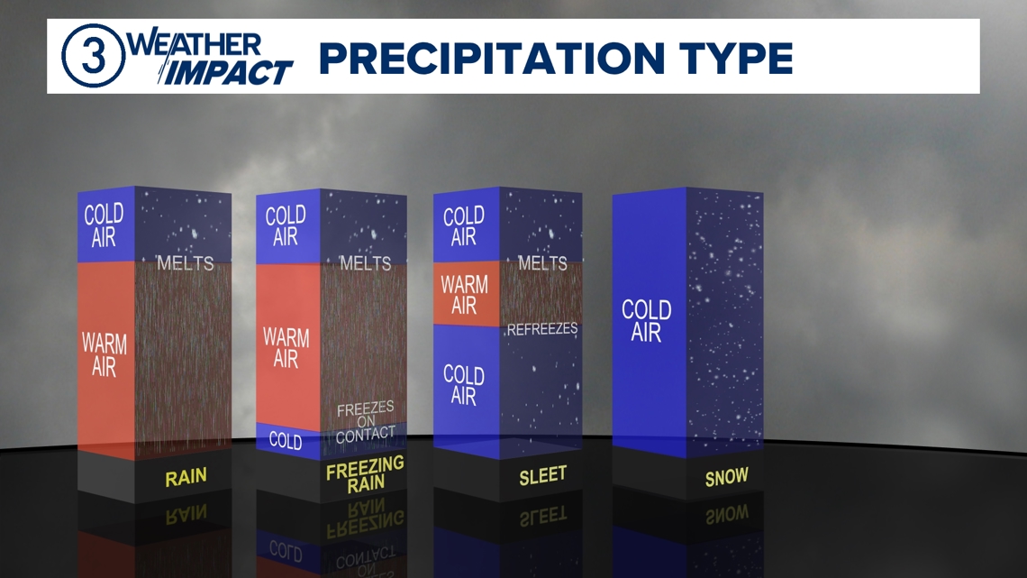
Rain forms when atmospheric temperatures remain above freezing (32°F) from the cloud level to the surface. Water droplets within clouds grow in size by colliding and coalescing with other droplets. Once they become too heavy to be suspended by air currents, they fall as rain. Rain is the most common type of precipitation in regions where surface temperatures are consistently warm.
2. Snow
Snow occurs when the entire atmospheric column is below freezing. Ice crystals form in clouds when water vapor directly deposits onto tiny particles, like dust. These crystals grow into snowflakes as they collide with others. Snowflakes retain their frozen structure because the temperature never rises above 32°F during their journey to the ground.
3. Sleet
Sleet, also known as ice pellets, forms when snowflakes pass through a warm layer of air in the atmosphere, partially melting into raindrops. However, if these raindrops then fall through a deep layer of freezing air closer to the surface, they refreeze into small, solid pellets before reaching the ground. This mix of warming and cooling layers creates sleet.
4. Freezing Rain
Freezing rain starts similarly to sleet: snowflakes melt into raindrops as they pass through a warm layer aloft. However, in the case of freezing rain, the layer of freezing air near the ground is too shallow for the droplets to refreeze before hitting the surface. Instead, the supercooled water droplets freeze instantly upon contact with cold surfaces, creating an icy glaze. This phenomenon is often the culprit in hazardous winter conditions like icy roads and power outages.
The Role of Temperature Profiles
The key factor determining precipitation type is the temperature profile of the atmosphere, often visualized by meteorologists as a vertical slice of the sky. For example:
- Rain: Entirely warm air.
- Snow: Entirely cold air.
- Sleet: A "sandwich" with a warm layer aloft and a cold layer below.
- Freezing Rain: A thin layer of cold air at the surface beneath a warm air mass.


Other Influences
Humidity and elevation also play roles. High humidity can lead to larger snowflakes or heavier rain, while high elevations favor snow due to colder temperatures. Meanwhile, wind can enhance evaporative cooling, altering the temperature profile and potentially changing the precipitation type.
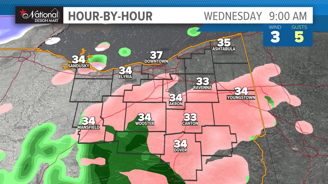
This week we may very well run into some wintry mixing on Wednesday as yet another storm system pushes precipitation our way from the south. We may still have surface temperatures around freezing, so a brief window of freezing rain or sleet may be possible.


