
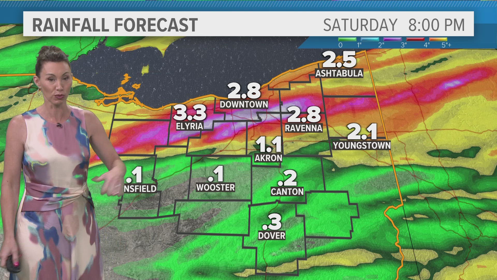
CLEVELAND — Saturday will be a Weather Impact Alert Day with heavy rain likely to start the day and thunderstorm chances that linger into the afternoon.
WHAT AND WHEN (UPDATE)
Rain will move in pre-dawn Saturday with periods of heavy rain possible in some areas through the morning. Additional scattered rain and storms will become possible in the afternoon - this is when the hail and high wind threat would be possible.
IMPACT
Very heavy rain is a possibility with thunderstorms that are expected the linger through the morning. Flash flood watches have been posted for some of the area. IF we get a break that is long enough and we can warm into the low/mid 80s, additional storms are expected in the area in the afternoon and we could contend with hail and high wind.
This will definitely impact any outdoor plans you may have. Roads will likely be riddled with puddles, and flooding is a possibility. Please remember a few quick quips:
When thunder roars, go indoors.
Turn around, don't drown.
They may sound simple but are rich with common sense.
NEED
For now, make sure you stay weather aware. These storms could pack a punch, and with so many people outdoors in the summer (whether camping overnight or enjoying the beach during the day), everyone needs to have a place to take shelter. The heavy rain may mean changing travel routes.
The WKYC App — which you can download for free HERE — is a great tool, as well, with location-based warnings and interactive radar.