CLEVELAND — (This forecast will be fine tuned: latest update Dec 17th)
Who wants a white Christmas? Technically for record-keeping purposes, a white Christmas requires at least 1 inch of snowfall remaining on the ground, whether it's from a previous snow or Christmas Day snowfall.
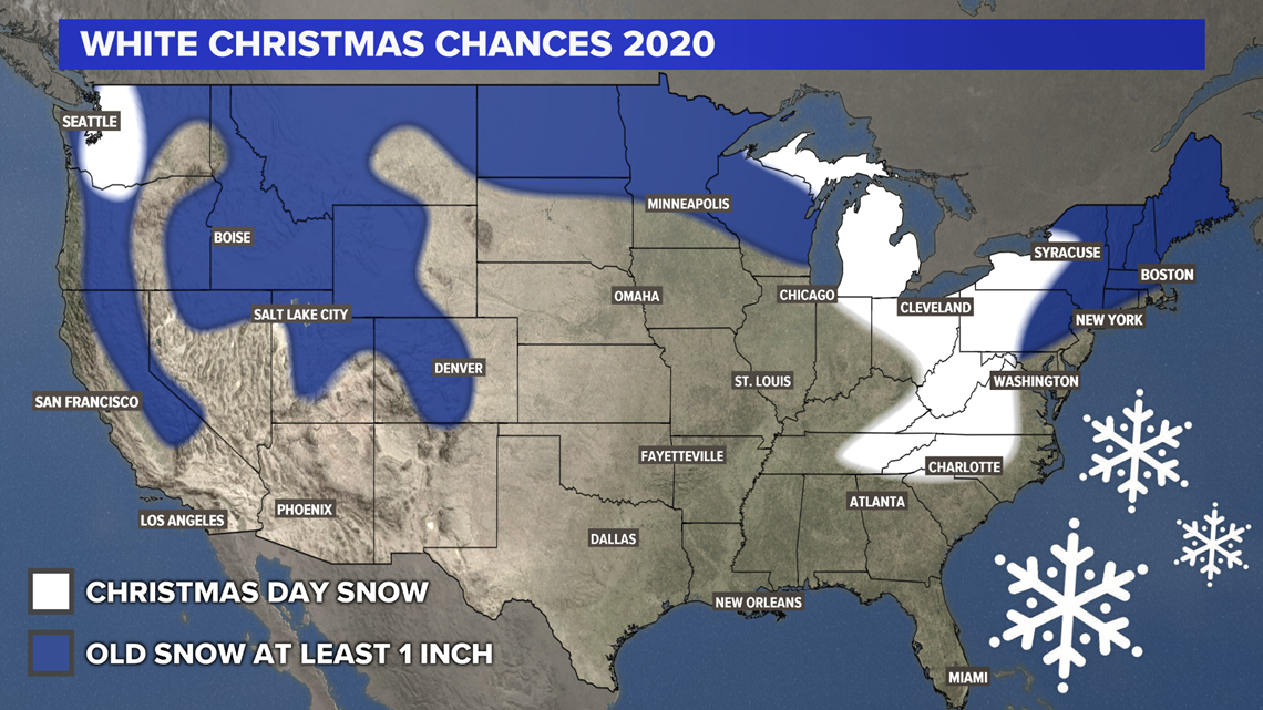
Here are the chances for a white Christmas across the United States. We've split chances into 2 categories: old snow and new snow.


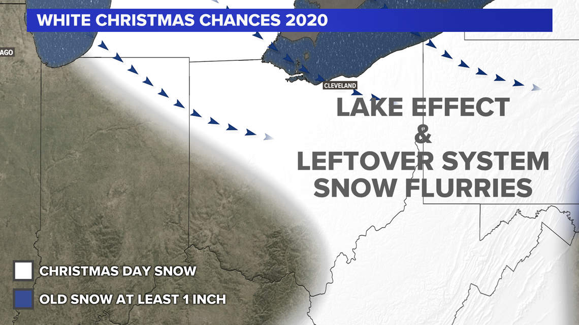
Most of the country will be dry by Christmas Day with lots of cold air spilling in from Canada. You can thank a strong cold front on Christmas Eve for that. There may be some leftover snow showers from that cold front, along with lake-effect snow, for the Great Lakes and possibly Appalachians.
GREAT LAKES
As a sharp cold front swings through a day or two before Christmas, a transition from rain to snow will be possible. Leftover scattered snow showers will be possible lingering into Christmas Day which will make some folks' landscapes white, especially in typical snowbelt regions for all 5 Great Lakes.
APPALACHIANS
The center of the upper-level low may be able to reach portions of Kentucky, North Carolina, Tennessee, and Virginia. It's hard to say whether it will be a white Christmas in these areas, especially with warm ground temperatures, but there is a decent chance for snow flurries in the air on Christmas Day, which is unusual for some of these southern states.
NORTHEAST
After a large snowstorm the week before, mainly inland areas of the northeast should be able to hold onto a couple inches of "old snow" for a white Christmas.
NORTHERN PLAINS
After a few rounds of some light snow the days before Christmas, cold air should keep the ground white in North Dakota, and parts of Minnesota and Wisconsin.
ROCKY MOUNTAINS
Christmas Day looks dry (except for the Cascades in Washington) but higher elevations should be able to remain white with existing snow packs.
Here is a closer look for Ohio. For the latest forecast, tap HERE.


