

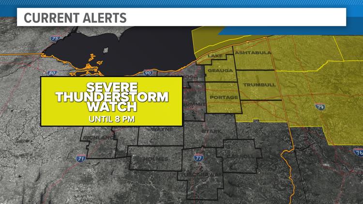
CLEVELAND — The National Weather Service has issued a Severe Thunderstorm Watch for the following counties in Northeast Ohio until 8 p.m. on Monday evening:
- Ashtabula
- Geauga
- Lake
- Mahoning
- Portage
- Trumbull
The NWS reports that impacted areas could see scattered wind gusts of up to 70 miles per hour with quarter-size hail. Frequent lightning is also possible.
The 3News Weather Team says highs are expected to push the 90-degree mark this afternoon. Humidity will make it feel extra uncomfortable today. It will also help trigger showers and storms at times, and any one of these rounds of storms could be strong to severe.
In terms of timing, this afternoon into the evening is when we can expect the first round of storms. Additional rounds are possible Tuesday before a frontal boundary finally clears us out Wednesday.