CLEVELAND — Editor's note: The video in the player above was sent in by a 3News viewer.
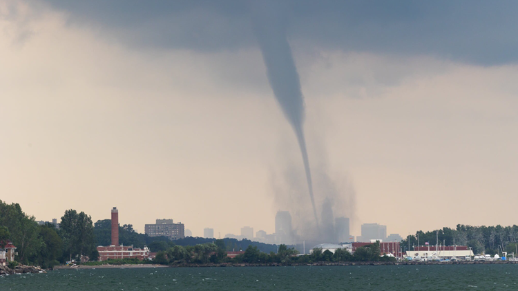
Social media is buzzing today after several waterspouts were spotted looming large over Lake Erie in Cleveland on Sunday afternoon.
According to the National Oceanic and Atmospheric Administration (NOAA), a waterspout is a tornado-like structure comprised of air and water mist.
Fair weather waterspouts are common in the fall near the Great Lakes because of the remnant of the warm water from the warm summer season. During autumn, cold air will spill south over the Great Lakes, creating a very unstable atmosphere (warm near the surface, cold air aloft -- unstable because warm air likes to rise). The static stability over the water is greatly reduced on these colder days and low-pressure forms above the water, creating these cold air funnels and may eventually create a full waterspout if the circulation can extend from the clouds to the water.
You can check out some of the best pics and videos captured in the tweets below:
Did you get a great picture or video of the waterspouts over Lake Erie? Send it to us! There are multiple ways that our WKYC producers can see your photos.
First... Use the WKYC app and scroll down to the "near me" option toward the bottom of the home screen. If you don't have the app, it's free to download (Android, Apple).
Second... You can also send your photos to us by texting your submissions to 216-344-3300. Remember, however, to include your name and location so we know where the content was captured and who to credit.
Third... You can do it the old-school way by posting your pics on social media on our Facebook and Twitter pages. Be sure to use #3LovesPets so it's easier for us to find your submissions.
MORE WEATHER:


