
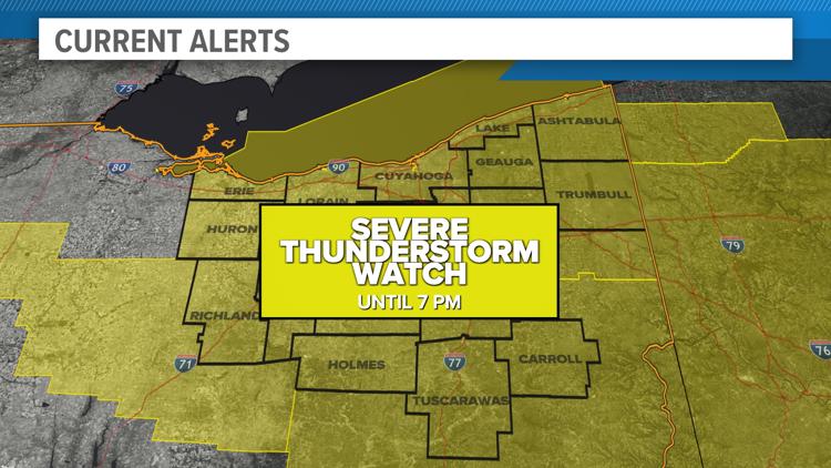
CLEVELAND — As we continue to be in a Weather Impact Alert Day, the National Weather Service has issued a Severe Thunderstorm Watch for all of Northeast Ohio until 7 p.m. tonight.
The following counties are part of the watch:
- Ashland
- Ashtabula
- Carroll
- Cuyahoga
- Erie
- Geauga
- Holmes
- Huron
- Lake
- Lorain
- Mahoning
- Medina
- Portage
- Richland
- Stark
- Summit
- Trumbull
- Tuscarawas
- Wayne
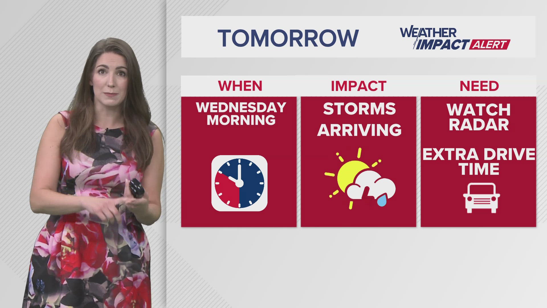
The 3News Weather Team says "strong to severe storms are expected to roll out of the northwest anytime from late morning through mid-afternoon. These storms will then move south, impacting our southern communities this afternoon."
"Any of these storms will be capable of producing damaging winds, very heavy rain and we can't rule out a tornado or two," our Senior Meteorologist Matt Wintz adds.
Our team reminds you to be weather aware, especially if you plan to be outside or driving. Have a way to get any warnings that are issued and keep an eye on the radar. Have a back up for any outdoor plans.